
Hiking the GR54: 12-Day Route, Refuges, Tips, Packing List
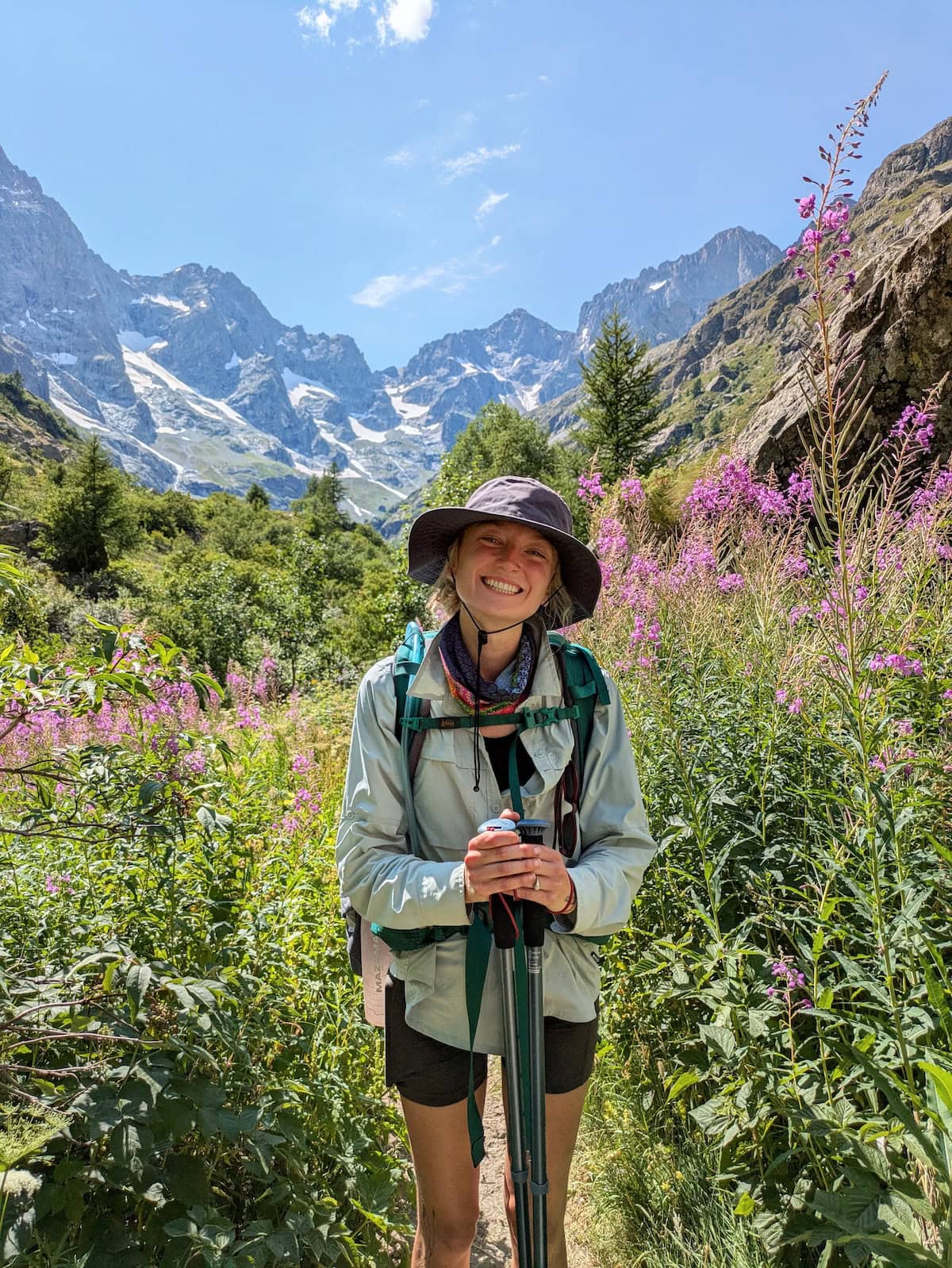
The GR54 is a 120-mile/193km thru-hike in the French Alps. It’s part of a network of long-distance trails, mainly based in France, called the Grandes Randonnées (hence the name “GR”).
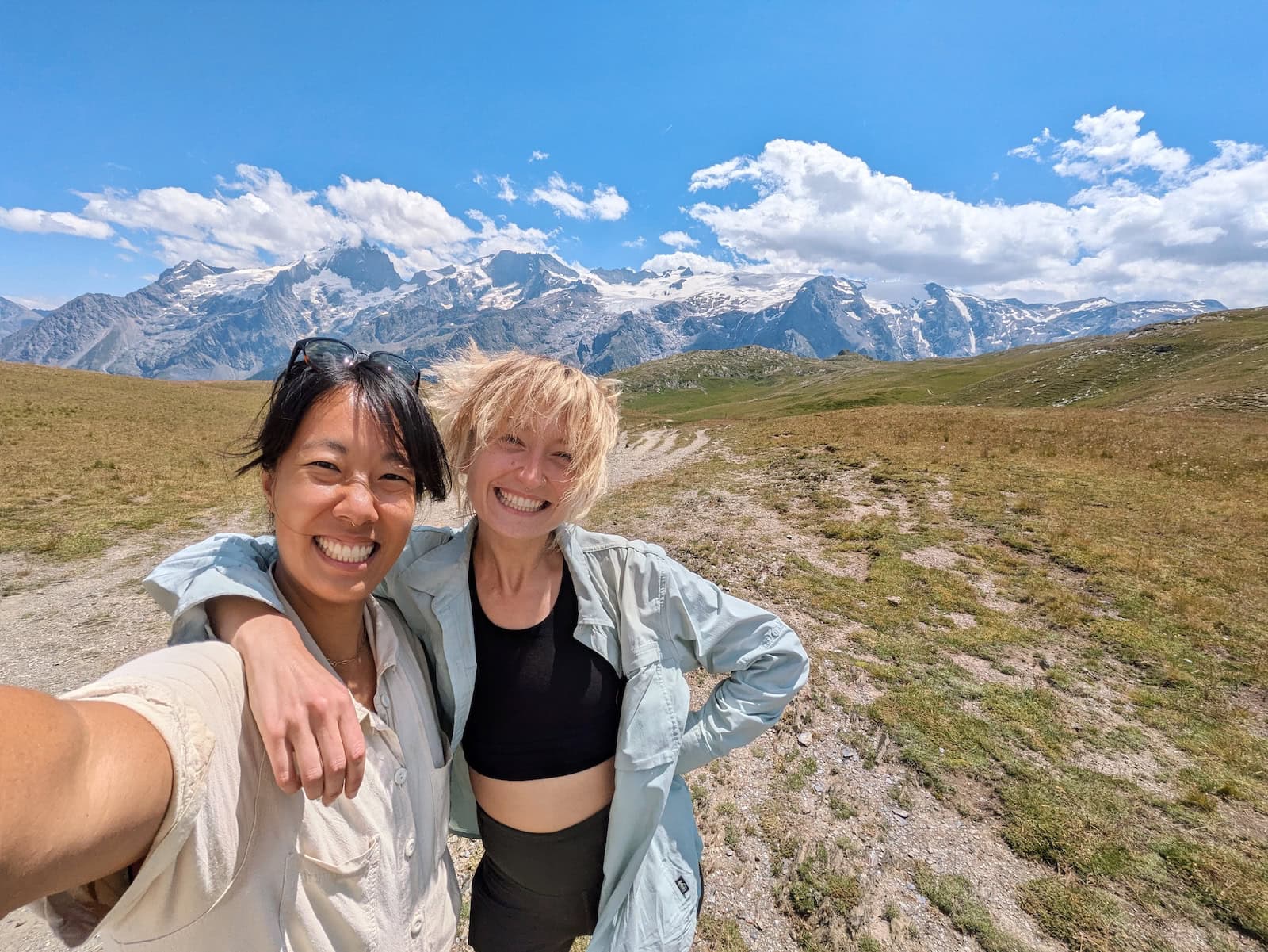
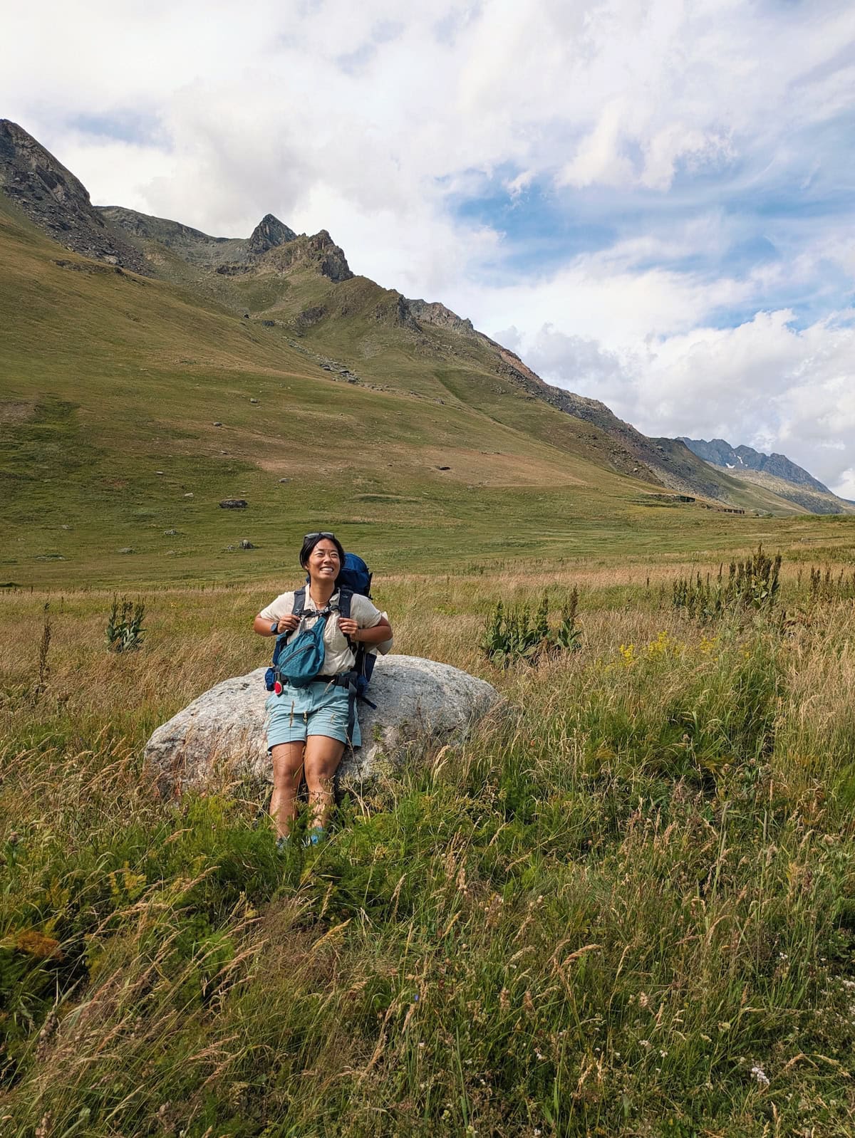
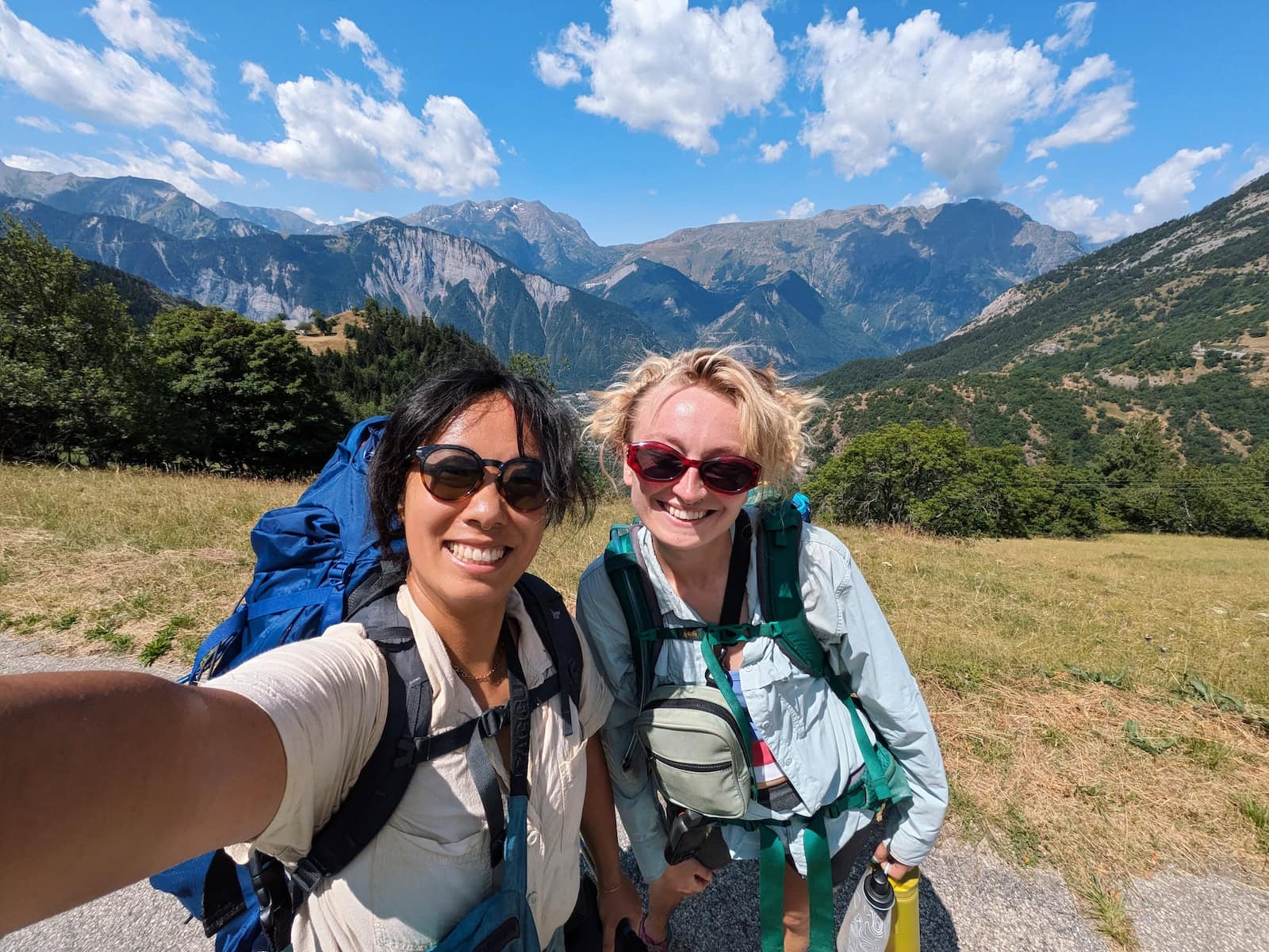
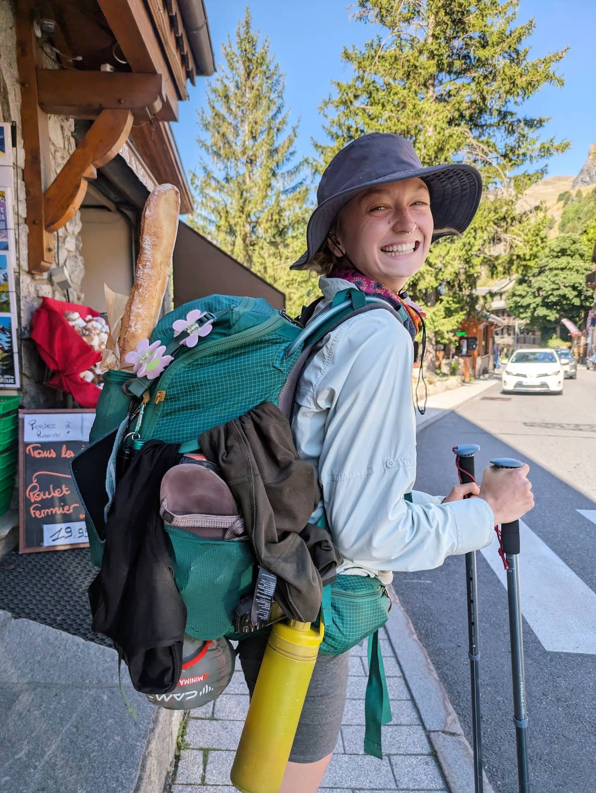
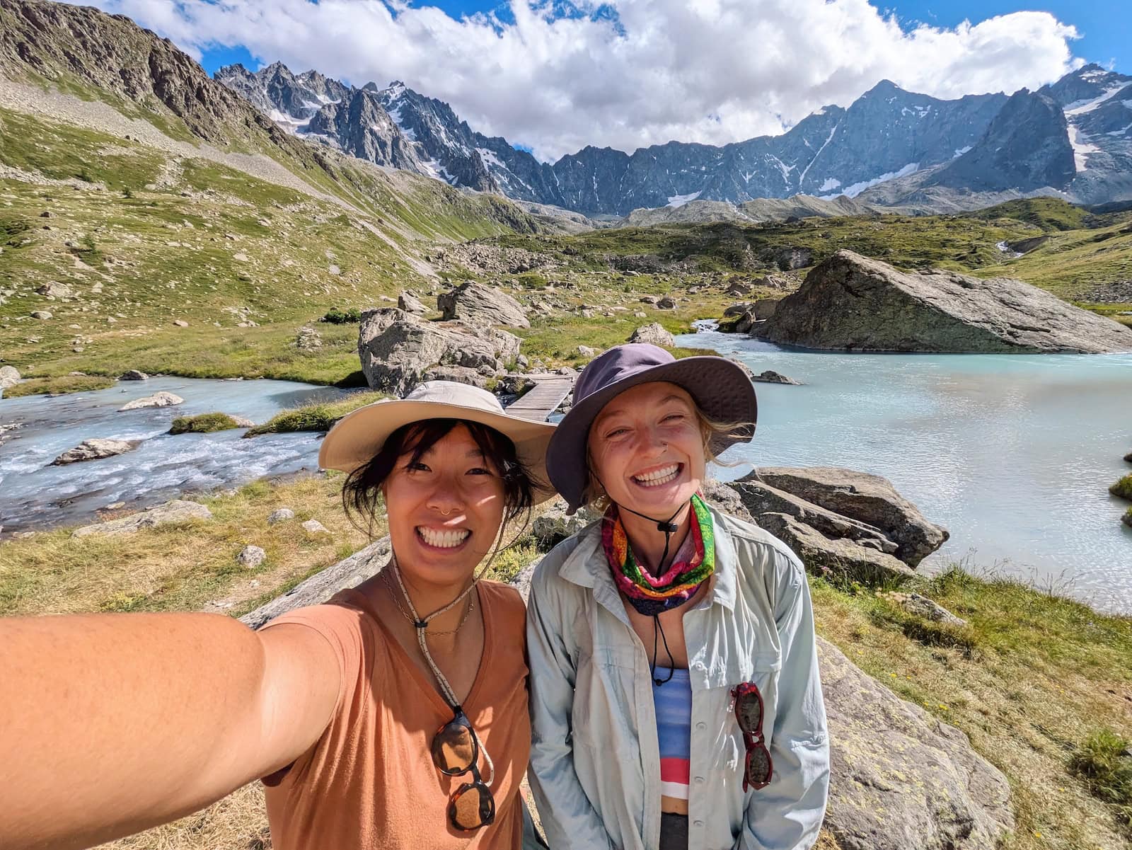
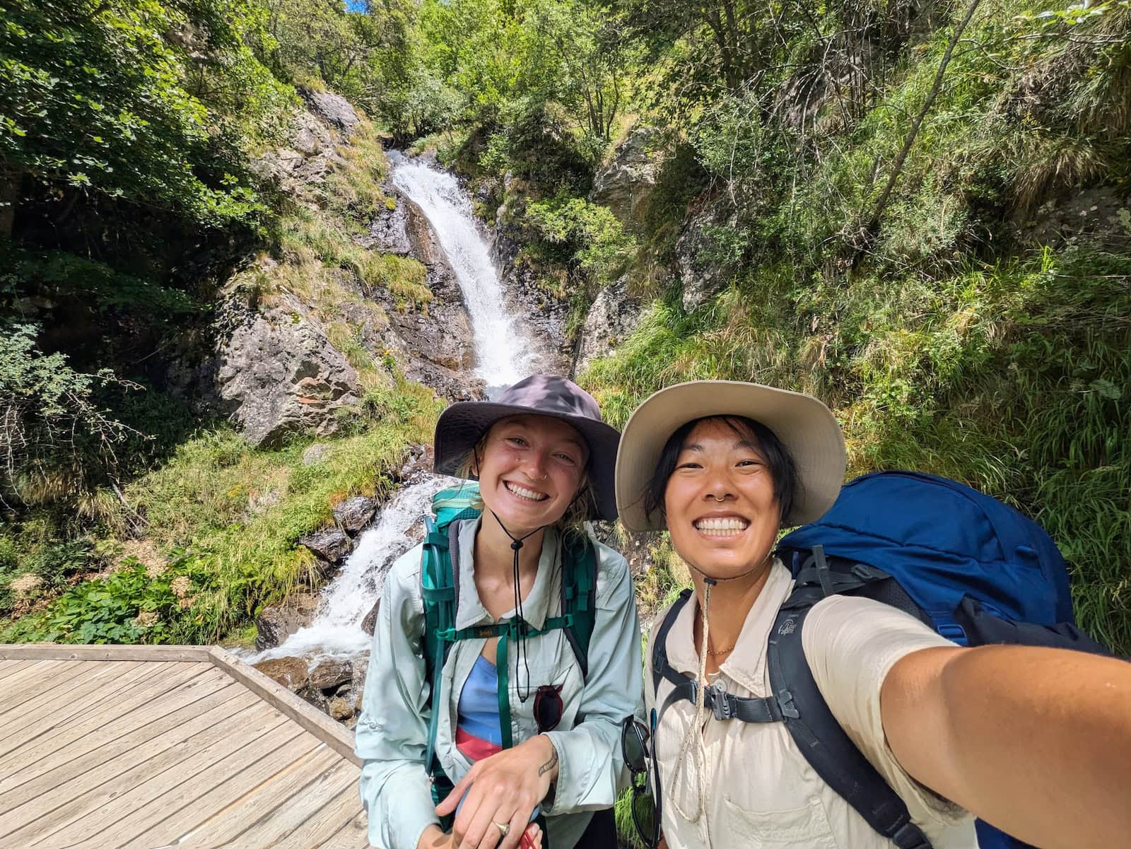
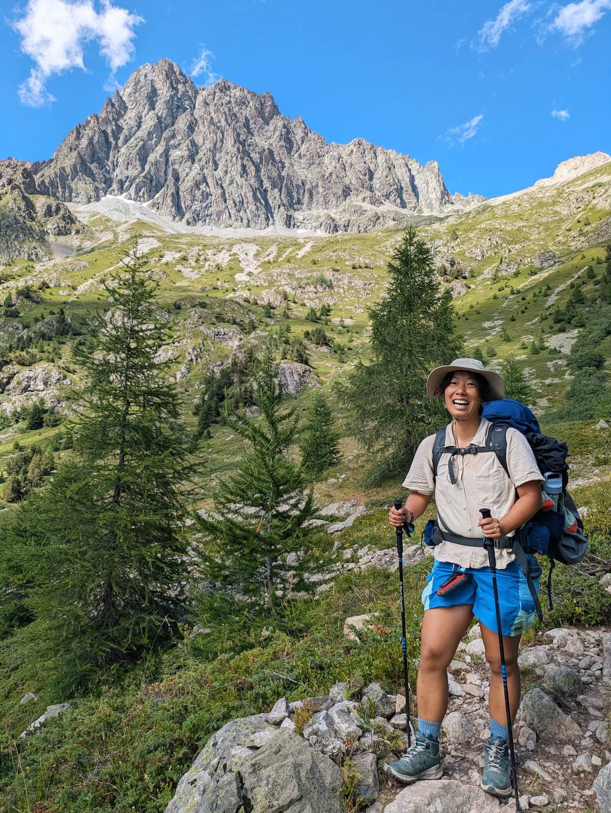
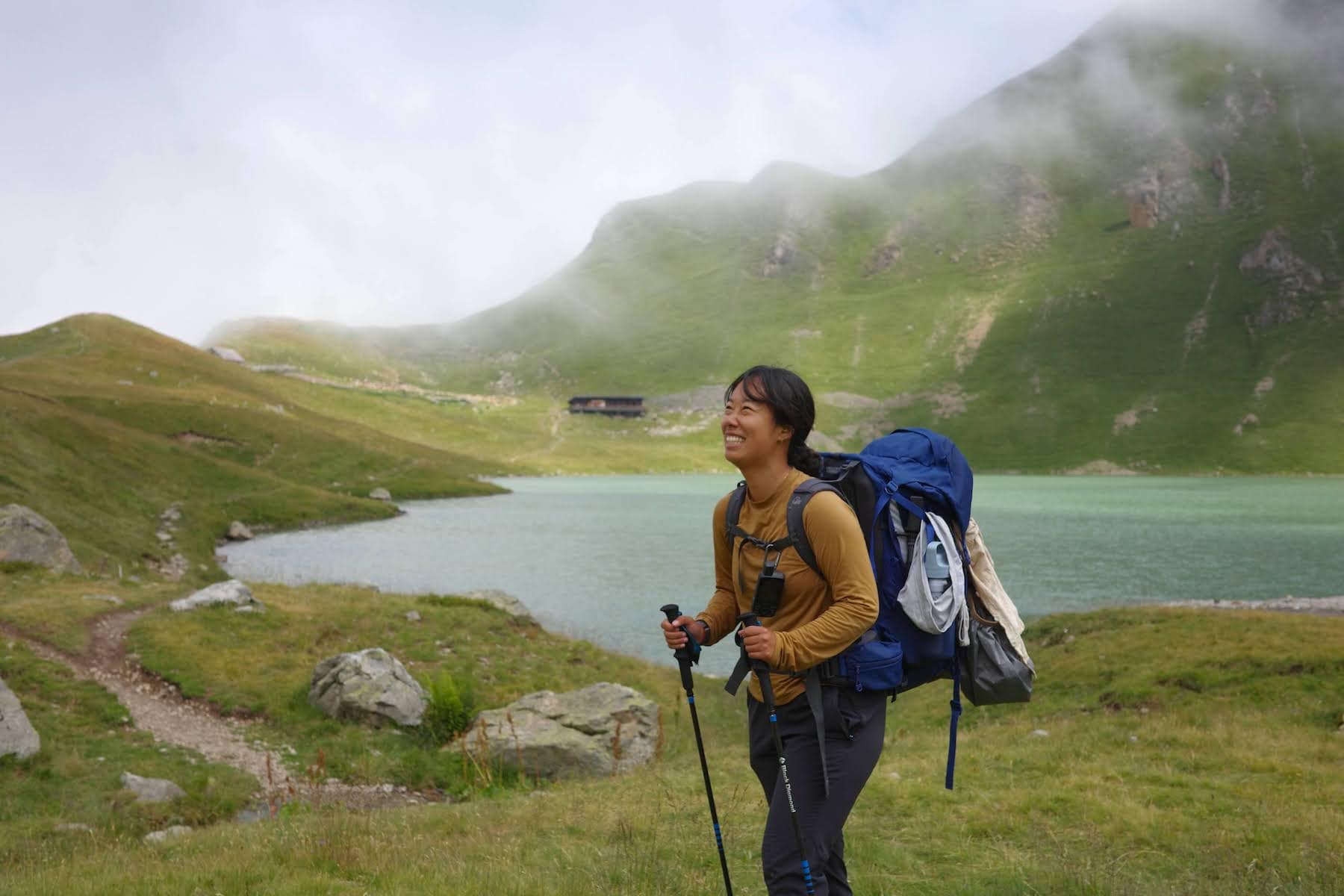
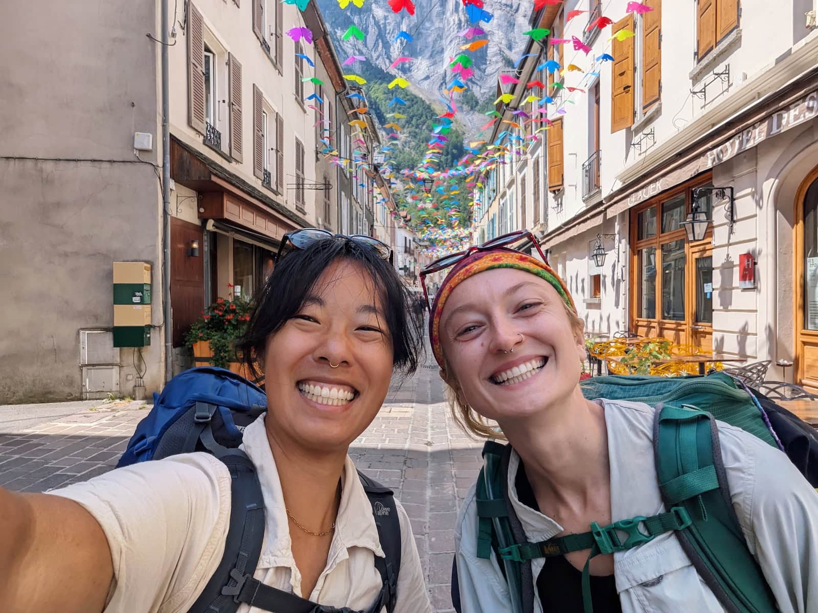
It was on my bucket list for 6 years, ever since I saw photos while living in France. In July 2025, I finally got to do this dream trek with my childhood friend.
This is my complete guide, including everything I wish I’d known before I started.
This post contains affiliate links, meaning I may earn a small commission on any purchases or bookings through those links.
GR54 Fast Facts + FAQs
How long is the GR54?
The GR54 is ~120 miles/193 kilometers with 37,125ft/11,300m of elevation gain. Most people do the trek in around 10-14 days. We did it in 12.
Where do you stay?
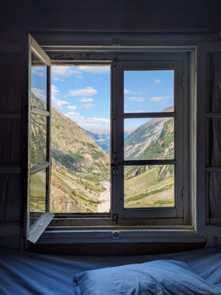
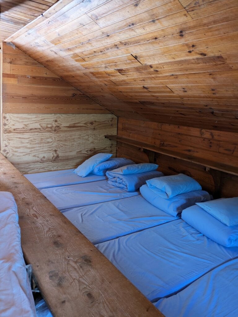
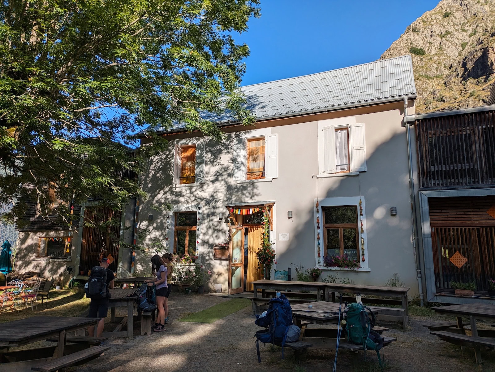
You can camp or stay in mountain huts (refuges). We did a mix of both! The refuges are dorm-style with usually 10+ beds in a room. They usually have a campground as well. There are also some nicer lodges along the way, and we stayed in private rooms a couple times. There is a stretch of days towards the end where your only options are refuges or camping, so be prepared for more rustic conditions.
What about dietary restrictions?
While I usually eat plant-based, I knew this was going to be a problem on this trip, so I ate vegetarian. I was worried that the refuge meals would be too low-calorie if I told them vegan. At one refuge, a guy also had specified vegan meals but ended up with a vegetarian dinner anyways. Both Tessa and I ate vegetarian, but got sick of dairy by the end since everything was cheese-heavy. I would recommend packing a lot of snacks and your own meals if you’re vegan, gluten-free, or lactose-intolerant since the refuges don’t support these diets very well. Make sure to also let the refuges know in advance of any dietary needs.
How expensive is it to hike the GR54?
It can be as cheap or bougie as you want it to be. Since there is no permit required, if you camp the whole way and bring your own food, you’ll pay very little. If you want to hike hut-to-hut, it’s around 65 euros/night including dinner and breakfast. A bed in a refuge was around 25 euros/night, dinner was 28 euros, and breakfast was 13 euros. We also stayed at a couple inns that were around 100 euros per person with the bed and 2 meals (by the way, a stay and 2 meals is called demi-pension in French).
Where do you start the GR54?
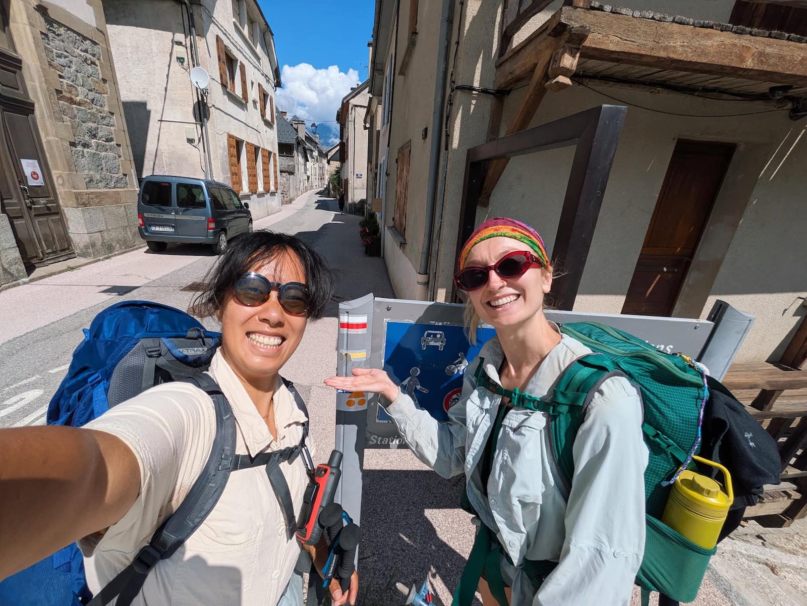
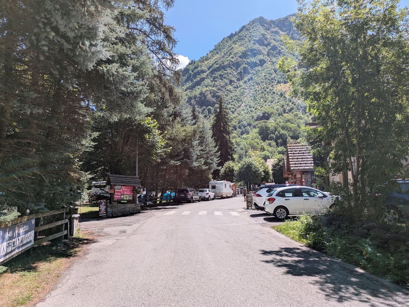
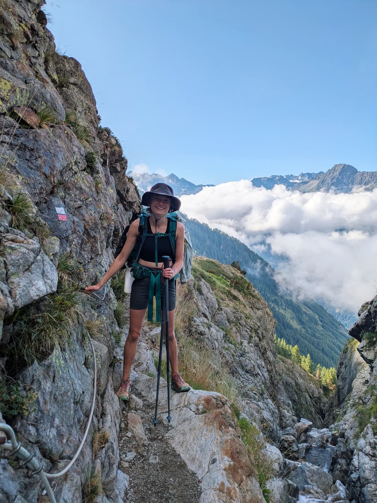
Since the GR54 is a loop, you can start it anywhere, but the most popular and most accessible town is Le Bourg d’Oisans. This is a 1-hour bus ride from Grenoble, a major French city. The trail is pretty easy to follow and is marked by the white and red lines that are characteristic of the GRs.
Is the GR54 hard?
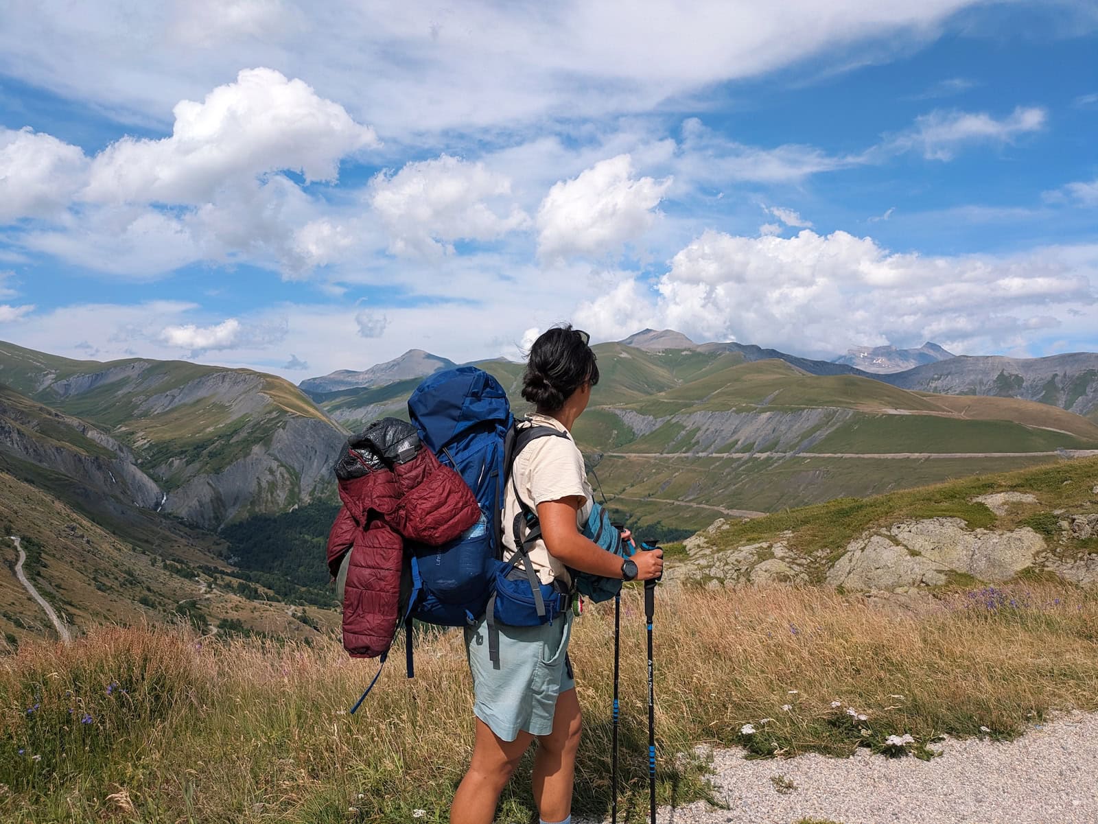
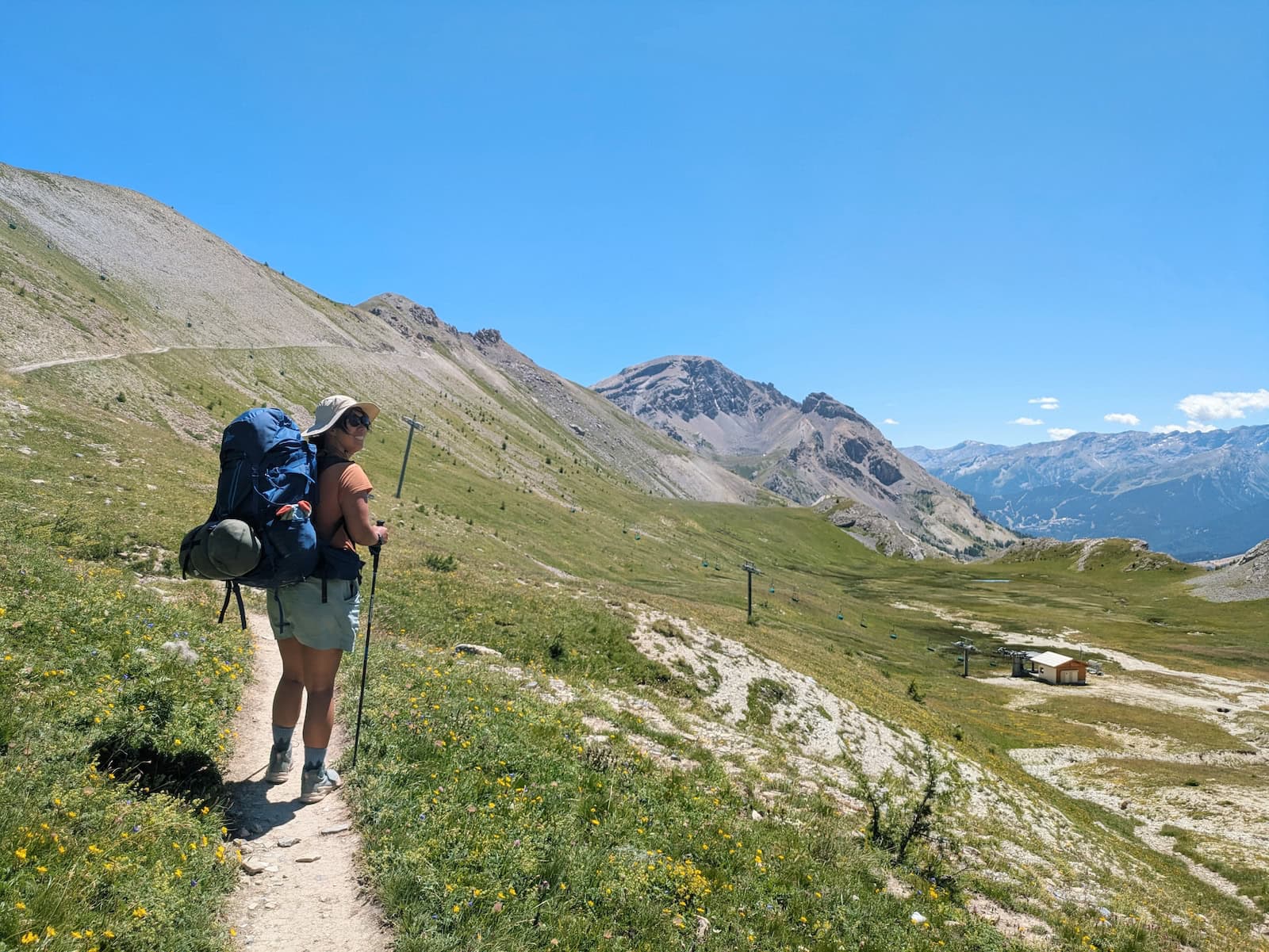
Oh boy. I’m a marathoner and this was brutal. I think the traditional 14-day route is more doable, but most of our days on the 12-day route were ~10 hours. I had never pushed myself to the point of true pain until this trek. It’s definitely a doozy and you need to be well-prepared. We also camped a couple days, and if you don’t carry a tent or sleeping bag, then it would be a lot easier.
GR54 12-Day Route + Places to Stay
Day 1: Le Bourg d’Oisans to Clavans-le-Bas
- Stats: 13.6mi/21.9km, 4740ft/1450 gain, 2710ft/830m loss
- Where to stay: Auberge du Savel
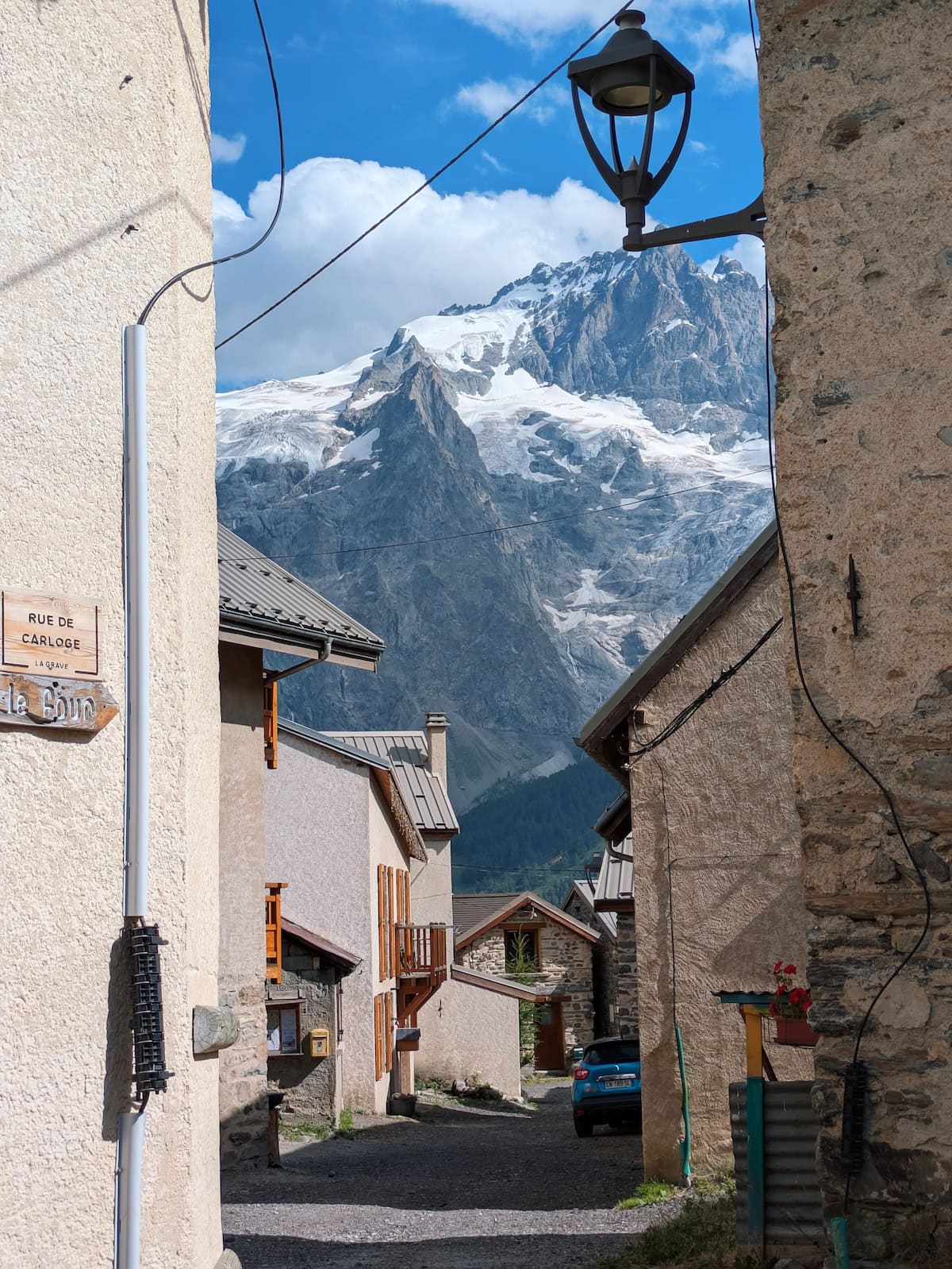
Day 2: Clavans-le-Bas to La Grave
- Stats: 11.9mi/19.2km, 3880ft/1180m gain, 3380ft/1030m loss
- Where to stay: RestAuberge La Reine Meije
Day 3: La Grave to Le Casset
- Stats: 13.8mi/22.2km, 3280ft/1000m gain, 3350ft/1020m loss
- Where to stay: camp or Gîte le Rebanchon
Day 4: Le Casset to Vallouise-Pelvoux
- Stats: 12mi/19.3km, 3100ft/940m gain, 4000ft/1220m loss
- Where to stay: Auberge Saint-Antoine
Day 5: Vallouise-Pelvoux to Refuge des Bans (offshoot of the GR54)
- Stats: 10.7mi/17.2km, 3700ft/1130m gain, 1090ft/330m loss
- Where to stay: Refuge des Bans
Day 6: Refuge des Bans to Refuge du Pré-la-Chaumette
- Stats: 13mi/21km, 4080ft/1240m gain, 4960ft/1510m loss
- Where to stay: Refuge du Pré-la-Chaumette
Day 7: Refuge Pré-la-Chaumette to Refuge du Clot Xavier-Blanc
- Stats: 11.3mi/18.2km, 3790ft/1160m gain, 5010ft/1530m loss
- Where to stay: Refuge du Clot Xavier-Blanc
Day 8: Refuge du Clot Xavier-Blanc to Refuge des Souffles
- Stats: 11.2mi/18k, 3400ft/1040m gain, 1560ft/480m loss
- Where to stay: Refuge des Souffles
Day 9: Refuge des Souffles to Gîte les Arias
- Stats: 7.2mi/11.6km, 3260ft/990m gain, 3180ft/970m loss
- Where to stay: Gîte les Arias (camping or dorm)
Day 10: Gîte les Arias to Gîte le Béranger
- Stats: 7.4 mi/11.9km, 3260ft/990m gain, 3180ft/970m loss
- Where to stay: Gîte le Béranger
Day 11: Gîte le Béranger to La Danchère
- Stats: 12.5mi/20km, 6000ft/1830m gain, 7380ft/2250m loss
- Where to stay: Lauvitel Lodge
Day 12: La Danchère to Le Bourg d’Oisans
- Stats: 5.7mi/9.2km, 270ft/80m gain, 610ft/190m loss
- Where to stay: Go back to Grenoble and treat yourself to a nice hotel
GR54 Day by Day Breakdown
Day 0: Grenoble to Le Bourg d’Oisans
If you’re coming in internationally, I would recommend flying into Paris, taking the high-speed train (TGV) to Grenoble, and then taking the T75 bus to Le Bourg d’Oisans. You can buy bus tickets at the station for around 8 euros (make sure you select all the zones you’ll be passing through; if I remember correctly, 3 zones).
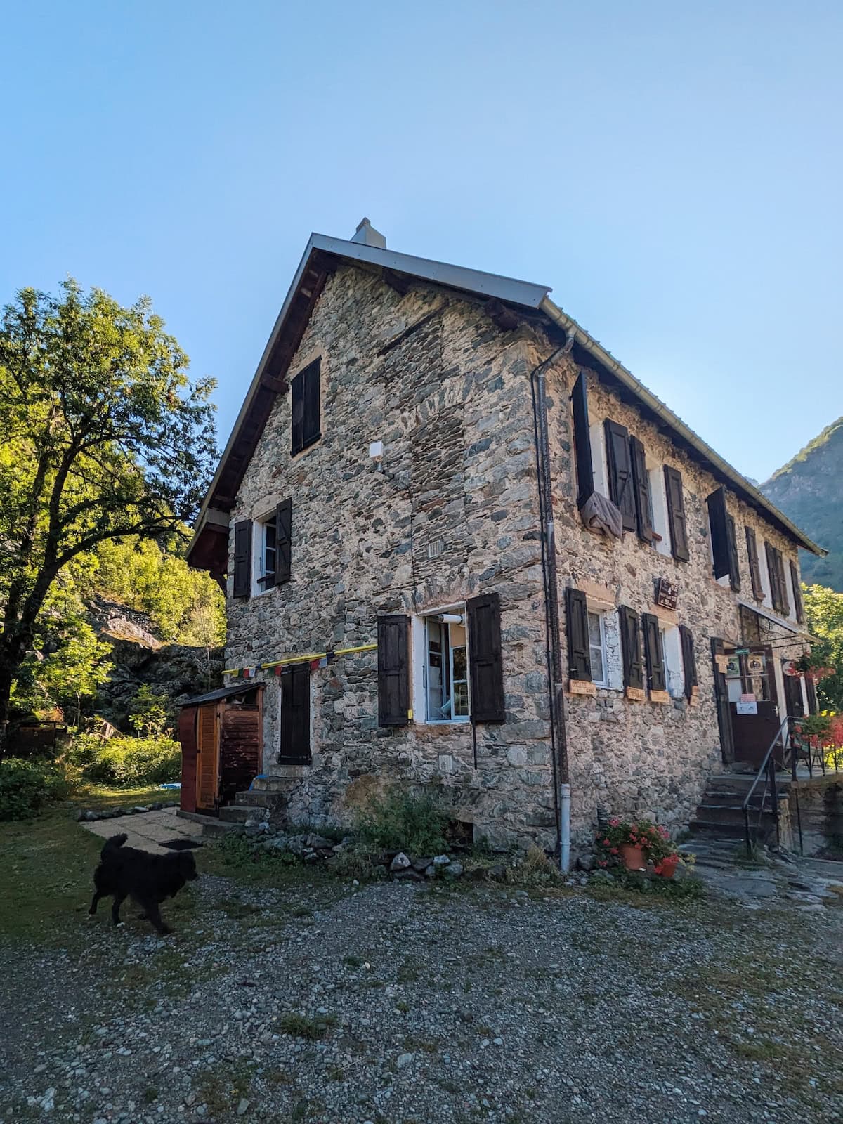
My friend and I spent one night each in Grenoble and Le Bourg d’Oisans before starting the trek. I highly recommend finding a host or hotel that will let you leave any non-hiking gear and pick it up on the way back. We stayed with a local, Blandine, and she was very kind to let us do this. She also gave us good advice to be careful around sheepdogs as we hadn’t heard that yet.
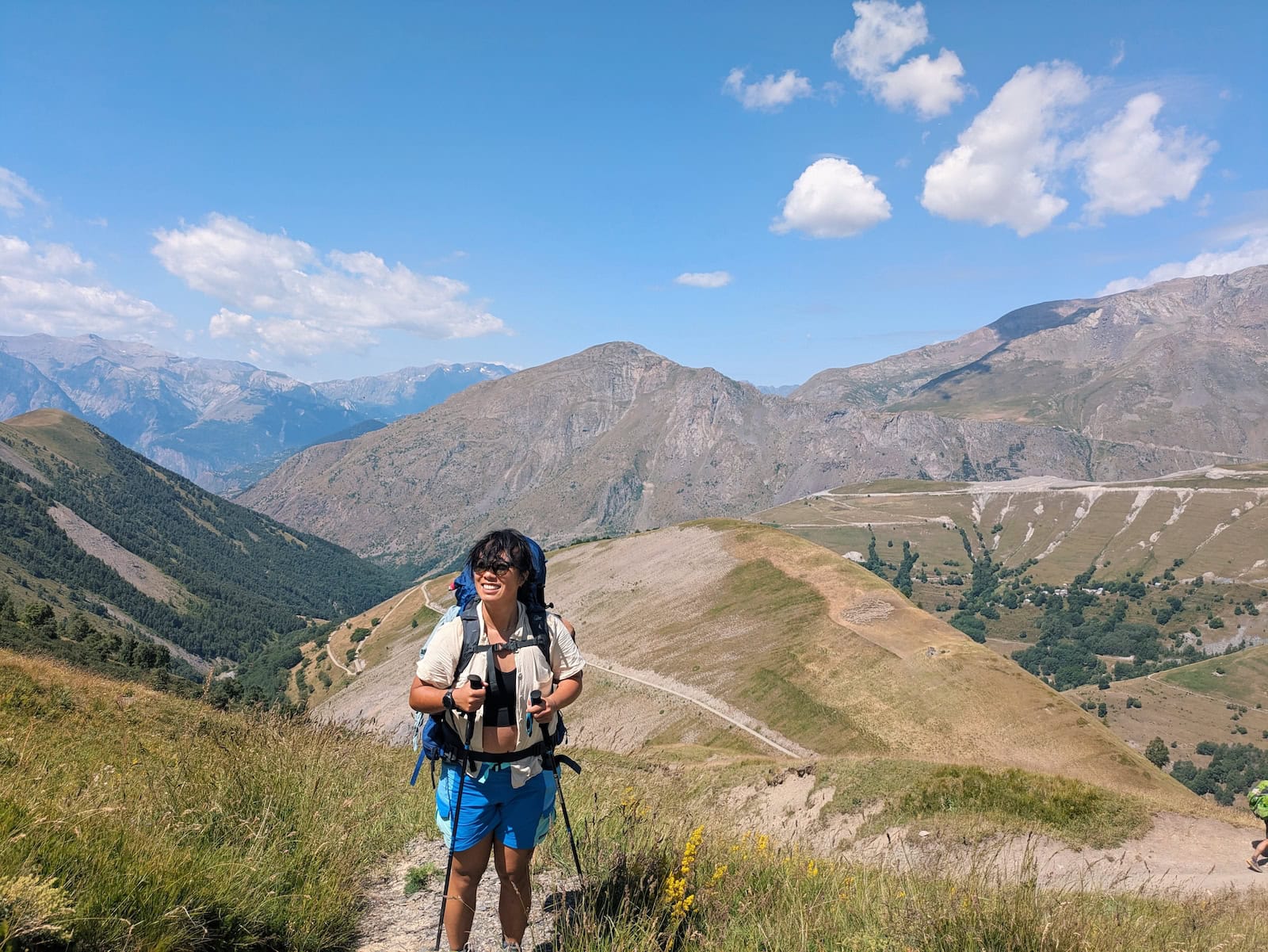
Day 1: Le Bourg d’Oisans to Clavans-le-Bas
Stats: 13.6mi/21.9km, 4740ft/1450 gain, 2710ft/830m loss
Where to stay: Auberge du Savel
You can leave directly from the town and start the trek. The original trailhead seemed to be blocked off, so my friend Tessa and I ended up hopping the fence and then had to some bouldering at the start. We were following the GPX trail we downloaded, but I think there’s potentially a different a different entry point. Ours was quite brutal!
We spent the next stretch in the forest and had lunch by a small fountain in a village. There was a tiny restaurant in the village, but it was closed for Bastille Day. We passed another cafe on the trail later on, and it was also closed.
The views were pretty but not stunning until we reached the final stretch near Col de Sarenne. This is where it finally felt like we were in the true wilderness. We were so grateful to find an open mountain cafe with omelettes and drinks (they got the eggs from their own mountain chickens).
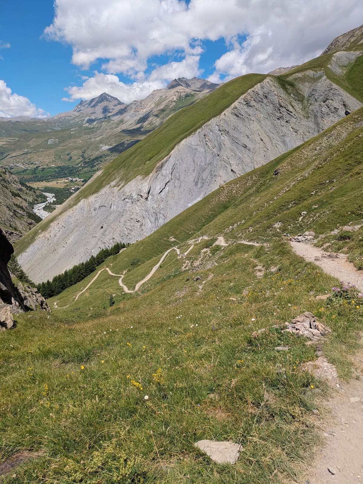
From there, it was a steep descent to Clavans-le-Bas along rocky switchbacks and then a gentler forest stretch.
We stayed in Auberge du Savel, which had a private room and bathroom plus meals. The meals were unfortunately pretty small though for vegetarians, and I was hungry. You should definitely be sure to order in advance since they had limited portions of everything.
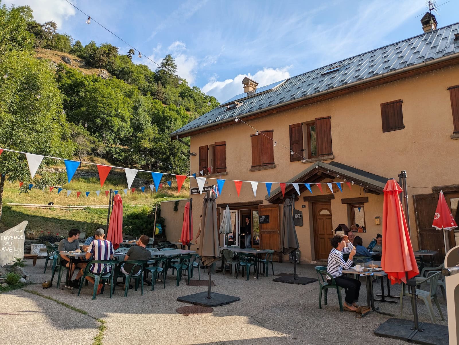
We’d made some trail friends that day and ate with them at the auberge before they turned in for the night at their campsite.
Day 2: Clavans-le-Bas to La Grave
Stats: 11.9mi/19.2km, 3880ft/1180m gain, 3380ft/1030m loss
Where to stay: RestAuberge La Reine Meije
The second day started with a descent through the forest, a short climb to a village, and then a series of switchbacks to some glaciers. We stopped after the first climb to have Orangina in the village and get ingredients for sandwiches for lunch.
The switchbacks were steep and mostly exposed to the sun. I definitely needed a few breaks.
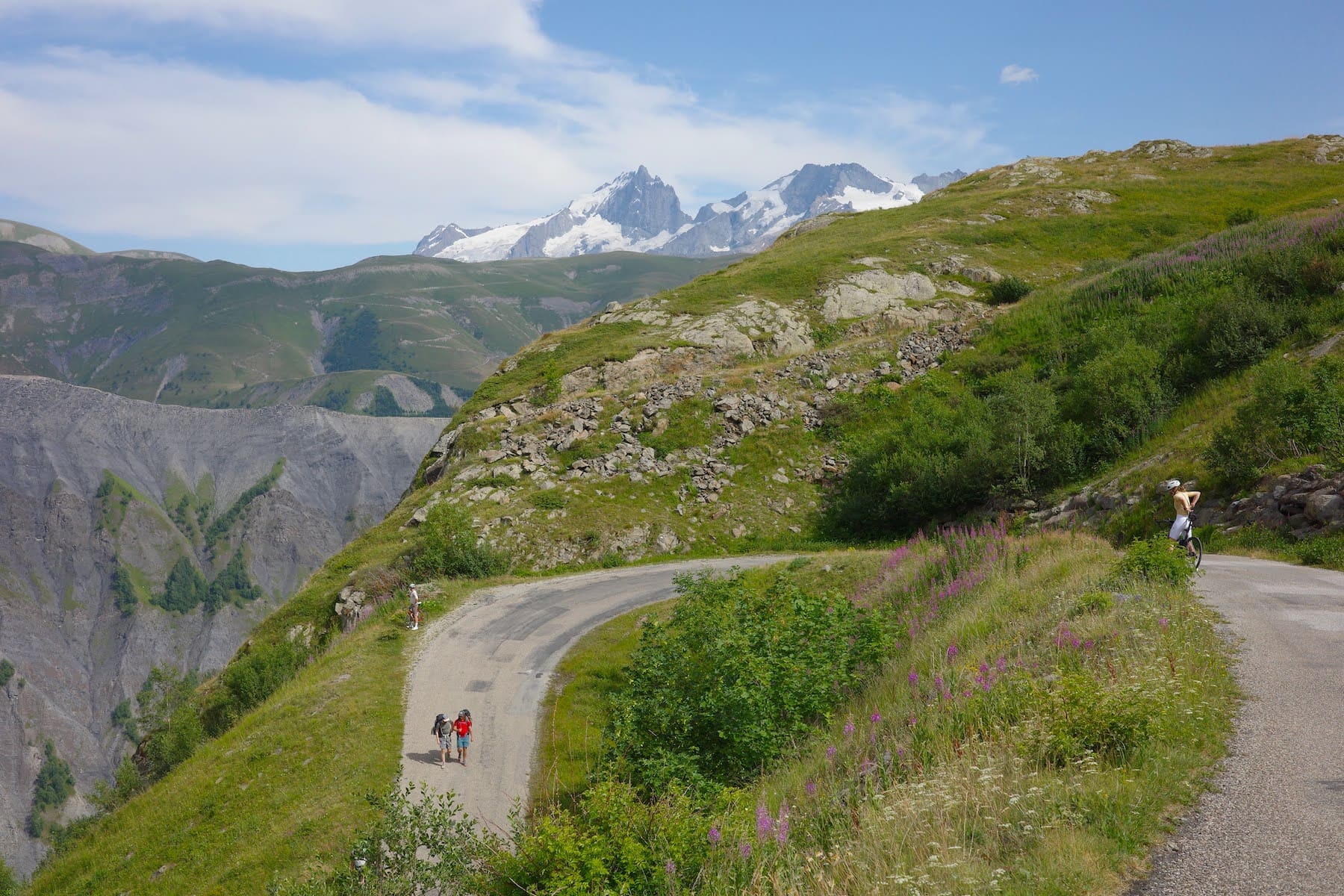
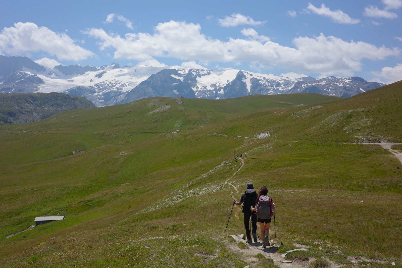
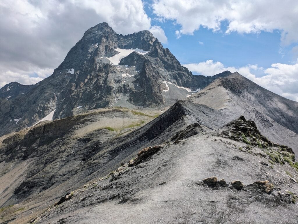
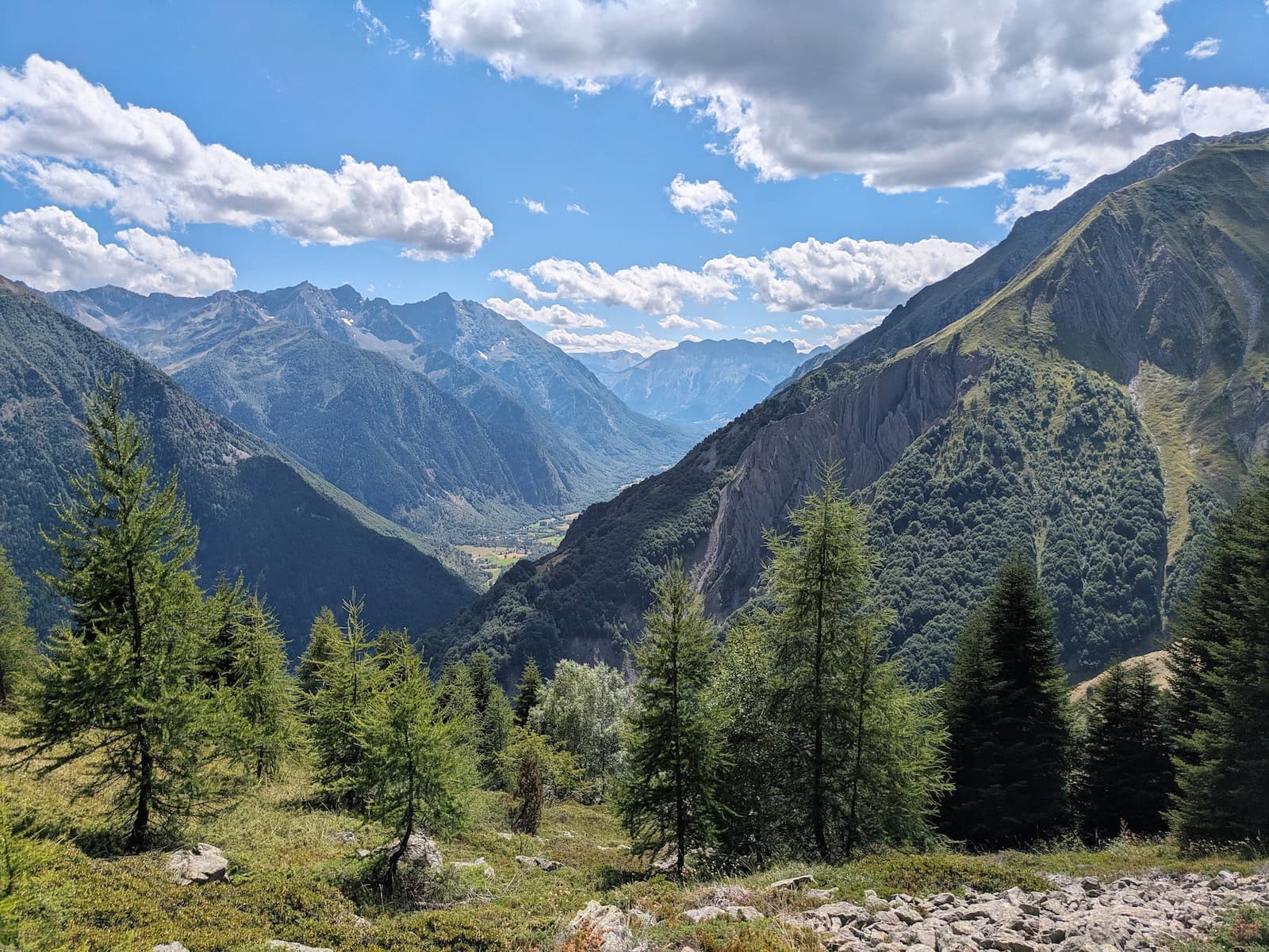
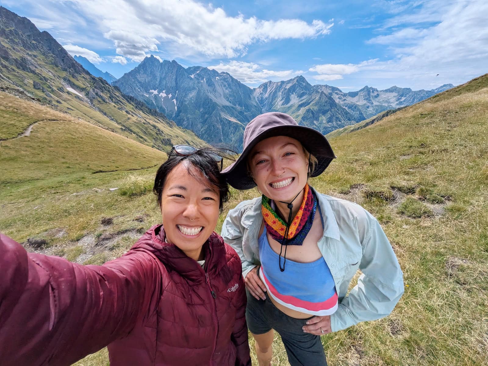
When we reached the top, the views were absolutely magical: grassy fields surrounded by snow-capped mountains in all directions. We ate lunch right next to a bubbling stream and we continued towards the glaciers for a perfect photo op as they towered over the trail.
From there, we walked through a mountain pass to a steep, rocky descent down to couple villages. If you get hungry, it’s definitely a good opportunity for a snack and pit stop. We had some crepes and more Orangina.
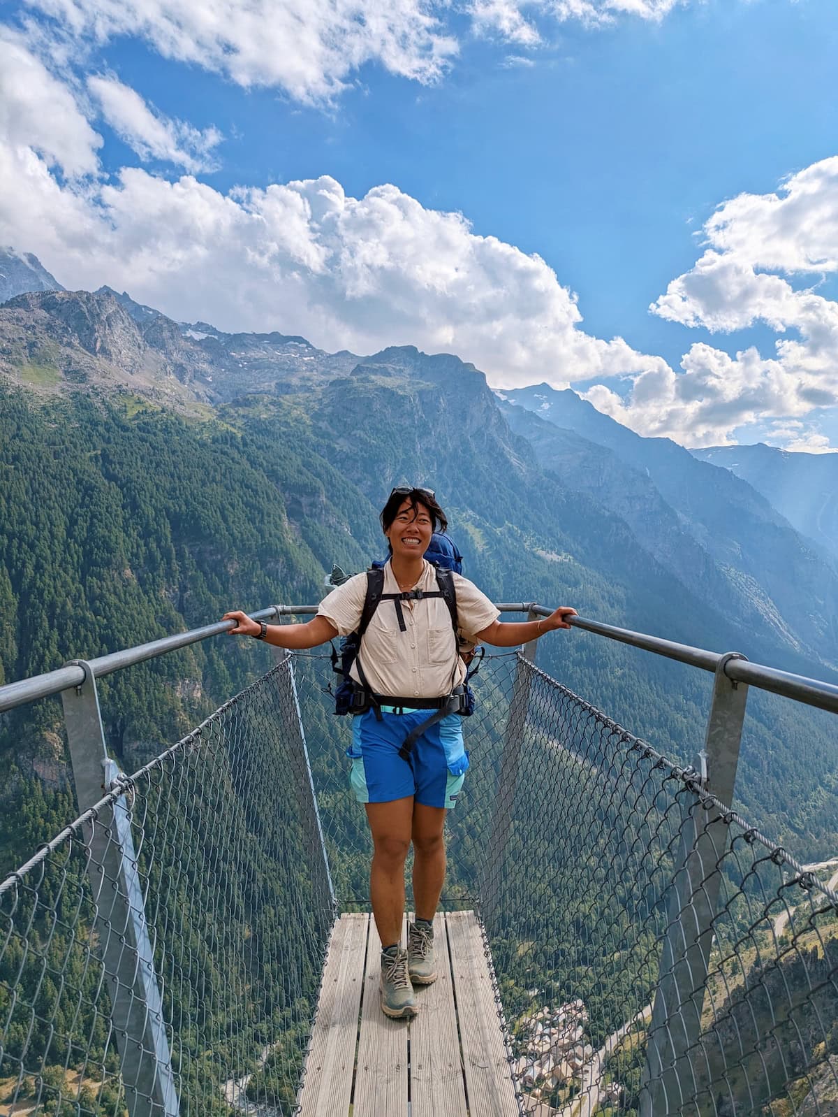
On the way to our final village, we passed by a small footbridge overlooking the valley which was a great photo op (and a bit scary).
One thing to be absolutely sure of is which “La Grave” you’re staying in. There’s one above and one below, and we accidentally went all the way down before realizing our stay was at the La Grave we’d already passed. We had to climb all the way back up, which was rough after a long day.
We loved our stay at RestAuberge La Reine Meije, which had fantastic views, amazing food, and the kindest host Pierre. The food was so nourishing and filling after a long day (and the small portions on our first day). We had three courses with soup, tiny ravioli, and chocolate mousse.
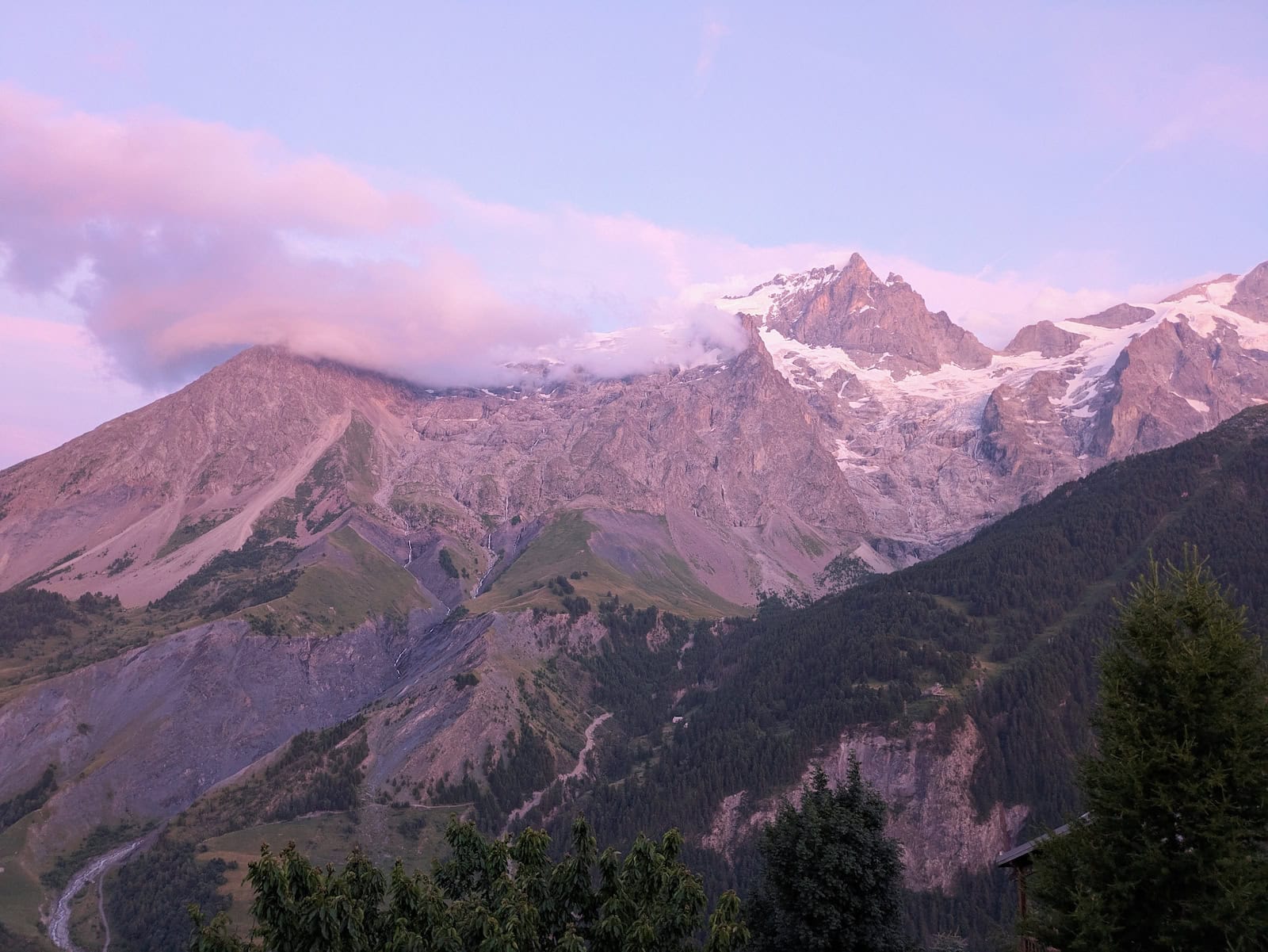
The sunset over the mountains was also beautiful from the terrace of the auberge. We slept well that night.
Day 3: La Grave to Le Casset
Stats: 13.8mi/22.2km, 3280ft/1000m gain, 3350ft/1020m loss
Where to stay: Gîte le Rebanchon or camping
This was one of my absolute favorite days of the trek. We started by redescending to the second La Grave, and buying some sandwich ingredients at the grocery store before climbing through the forest.
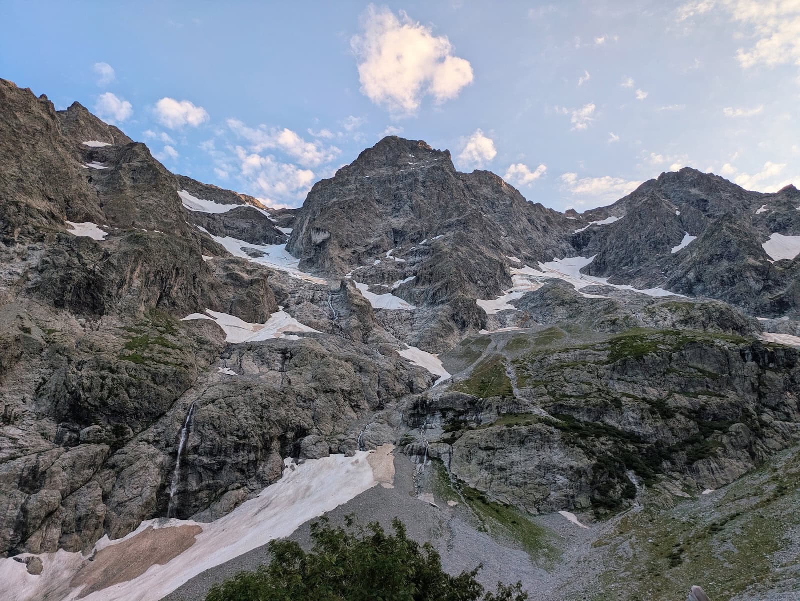
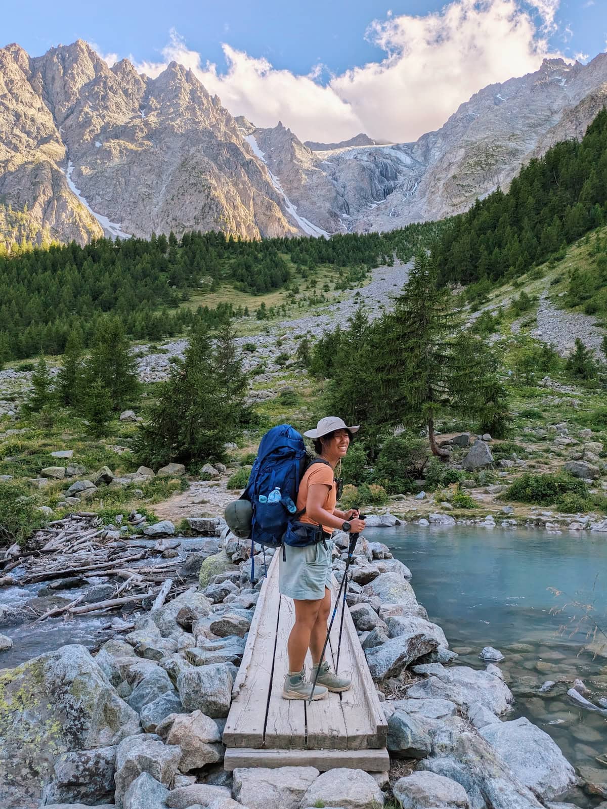
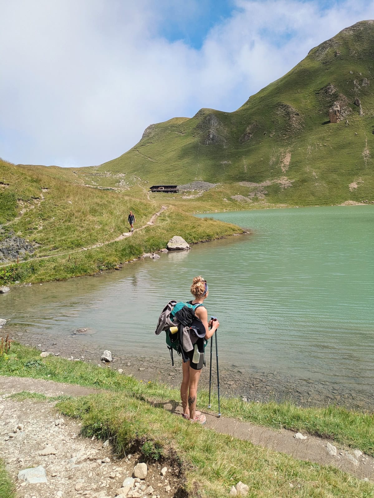
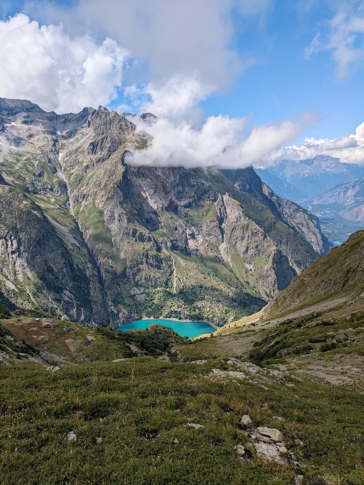
We had a flat section along a stream before encountering a beautiful turquoise lake. After snapping some photos, we started our climb for the day. This one was particularly rough as I started feeling the higher altitude and had trouble breathing.
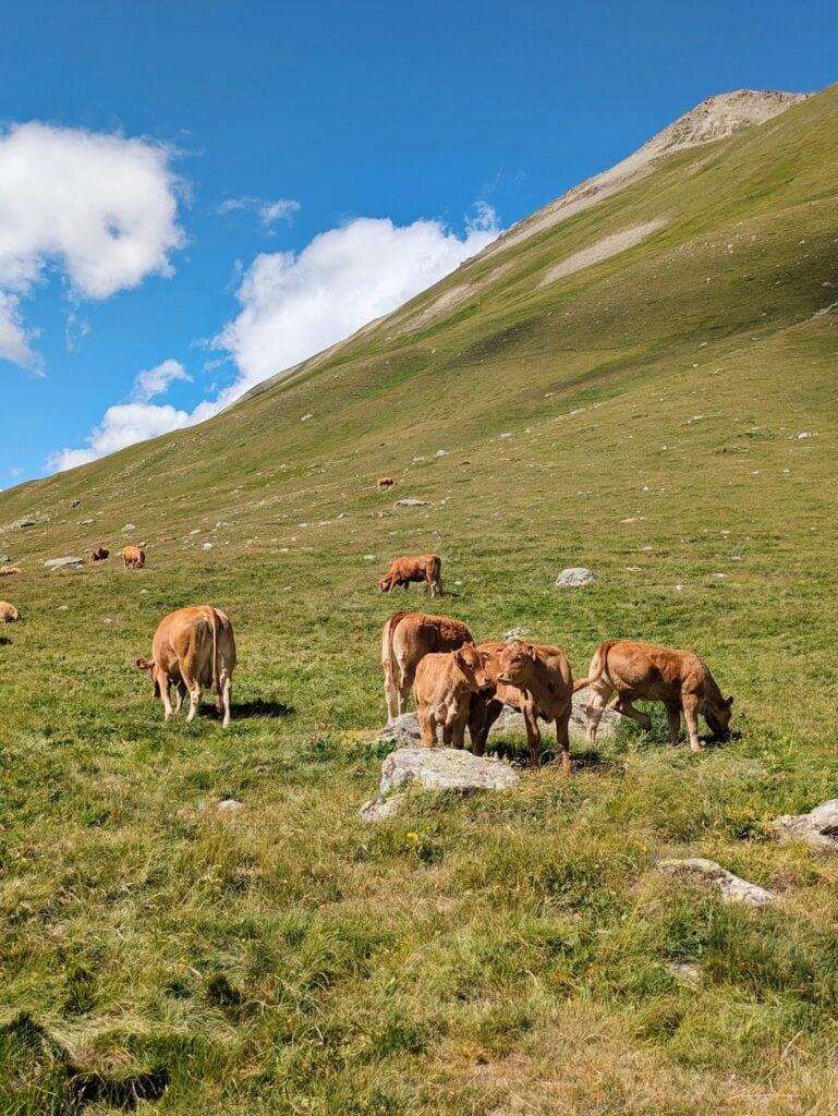
The payoff was incredible though, was we were greeted by more glaciers, mountain cows, and a bustling cafe where we stopped for pie and fizzy drinks.
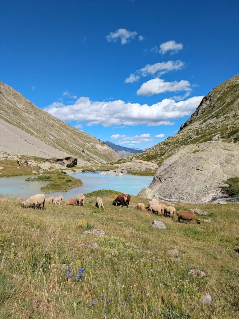
We weren’t prepared at all for the otherworldly views that came after we crossed the valley: milky blue glacial streams leading to alpine lakes. Sheep grazing along the water. Snow-capped mountains surrounding it all. We didn’t want to leave, and we were jealous of a guy who set up his tent in the area (though I don’t believe it was allowed right there).
On the descent, there’s also another turquoise alpine lake called Lac de la Douche, but it wasn’t very well-lit by the time we arrived.
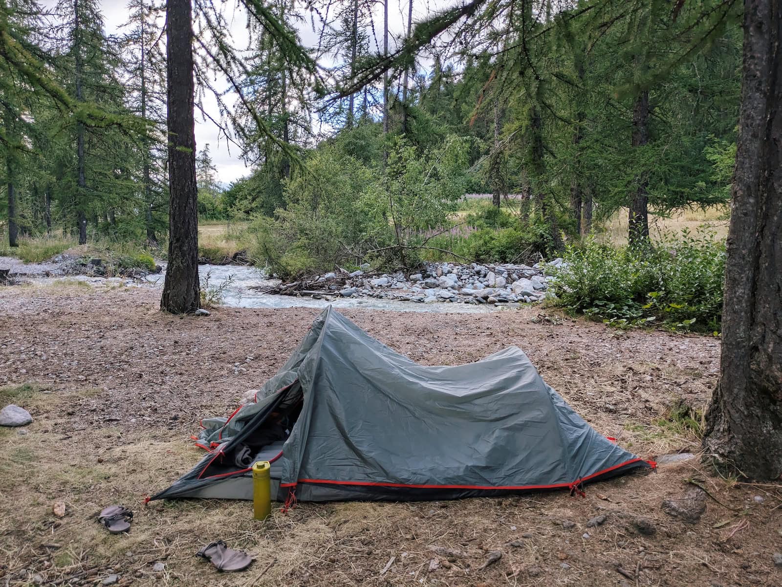
We finally reached the small town of Le Casset after a long and steep descent through the woods, but there was no food available unless you were staying in one of the lodges. We set up camp by the stream and cooked our freeze-dried food before turning in for the night.
Day 4: Le Casset to Vallouise-Pelvoux
Stats: 12mi/19.3km, 3100ft/940m gain, 4000ft/1220m loss
Where to stay: Auberge Saint-Antoine
This was one of the more underwhelming days in terms of views, but it’s never truly boring in the mountains. We started with a flat stretch and stopped in the village of Le Monêtier-les-Bains for pastries and lunch food. We were somehow able to find delicious vegan sandwiches in the local grocery store!
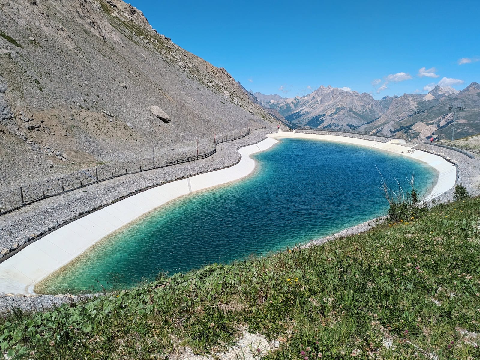
The rest of the hike was through the woods and along ski area. We ate our food at the peak and admired a turquoise man-made pool (not sure what it was for and it definitely wasn’t open for swimming).
The hike down was pretty exposed to the sun, and the both of us were in a lot of pain, so we stopped a few times to rest.
After a descent through the woods, we arrived in the village of Saint-Antoine, which had several options for stays. We spent the night in a private room in Auberge Saint-Antoine and ate at the hotel restaurant, which was on the fancier side. It wasn’t super veggie friendly but my friend was able to have a cheese fondue, and I just had fish since I was sick of dairy. Breakfast was self-serve.
At this point in the trek, we were also tired and exhausted from our heavy packs. We decided to mail ourselves a box to retrieve at a post office in Paris (called “la poste restante”). If I remember correctly, it was around 20 euros for 4kg, including the box. This made a huge difference particularly for my friend, as she’d brought extra clothes she hadn’t worn (we’ll cover packing later on).
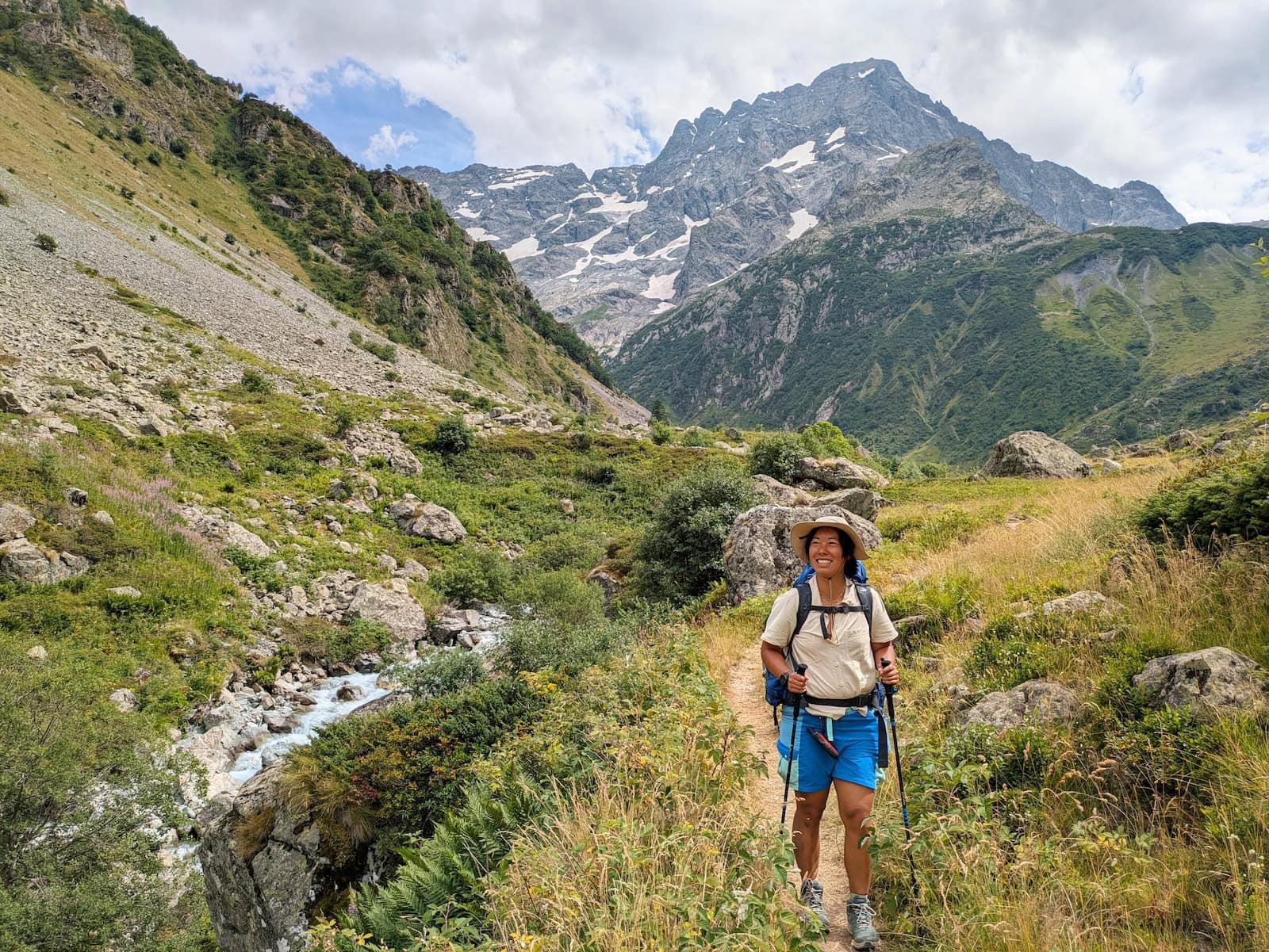
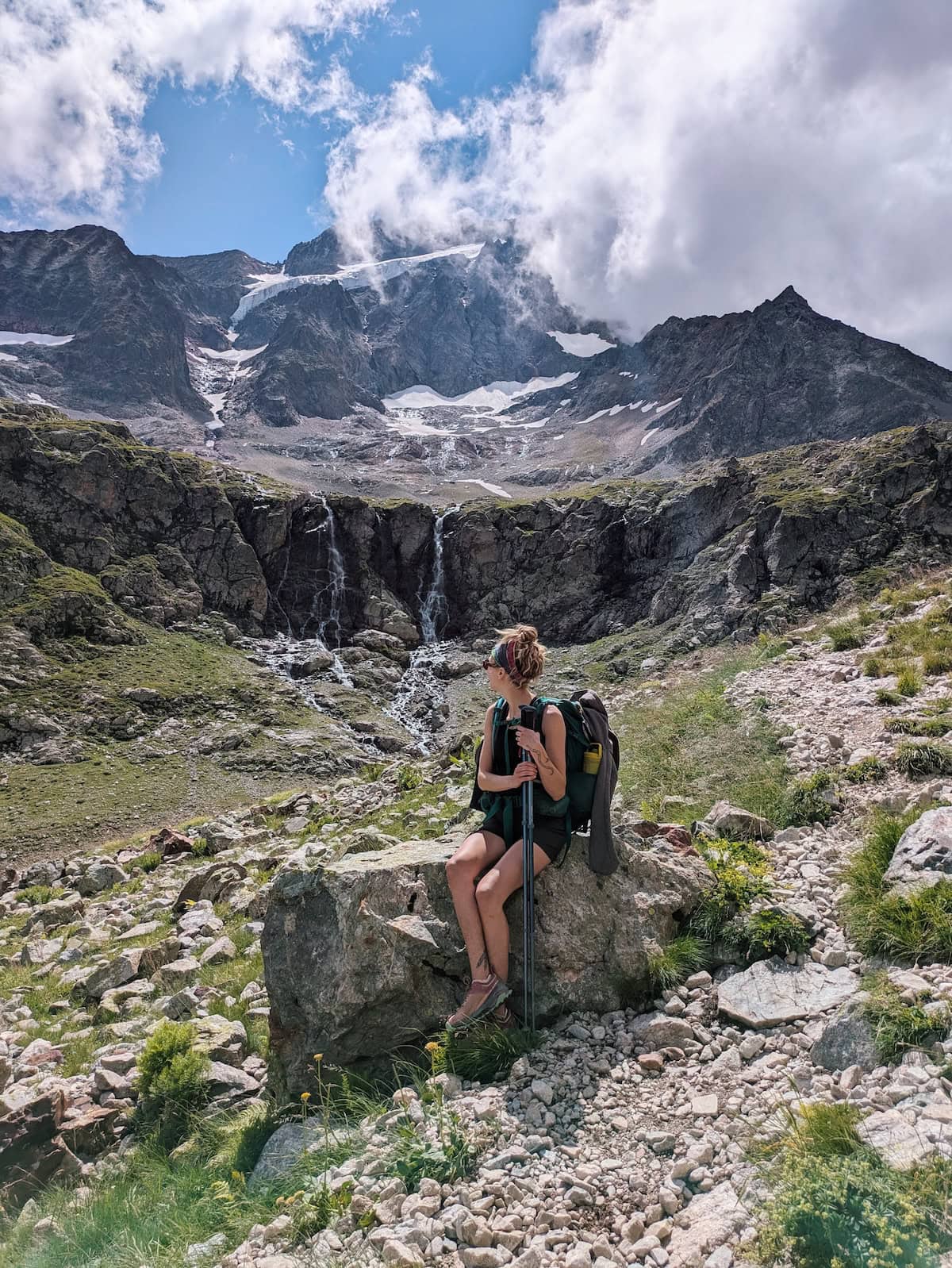
Day 5: Vallouise-Pelvoux to Refuge des Bans (offshoot of the GR54)
Stats: 10.7mi/17.2km, 3700ft/1130m gain, 1090ft/330m loss
Where to stay: Refuge des Bans
This day was our first offshoot from the GR54. If you want a more chill day, you could simply walk to Vallouise and spend the night there, or camp before the offshoot towards Refuge des Bans. This would save you an extra ~3-4 hours of hiking (round-trip).
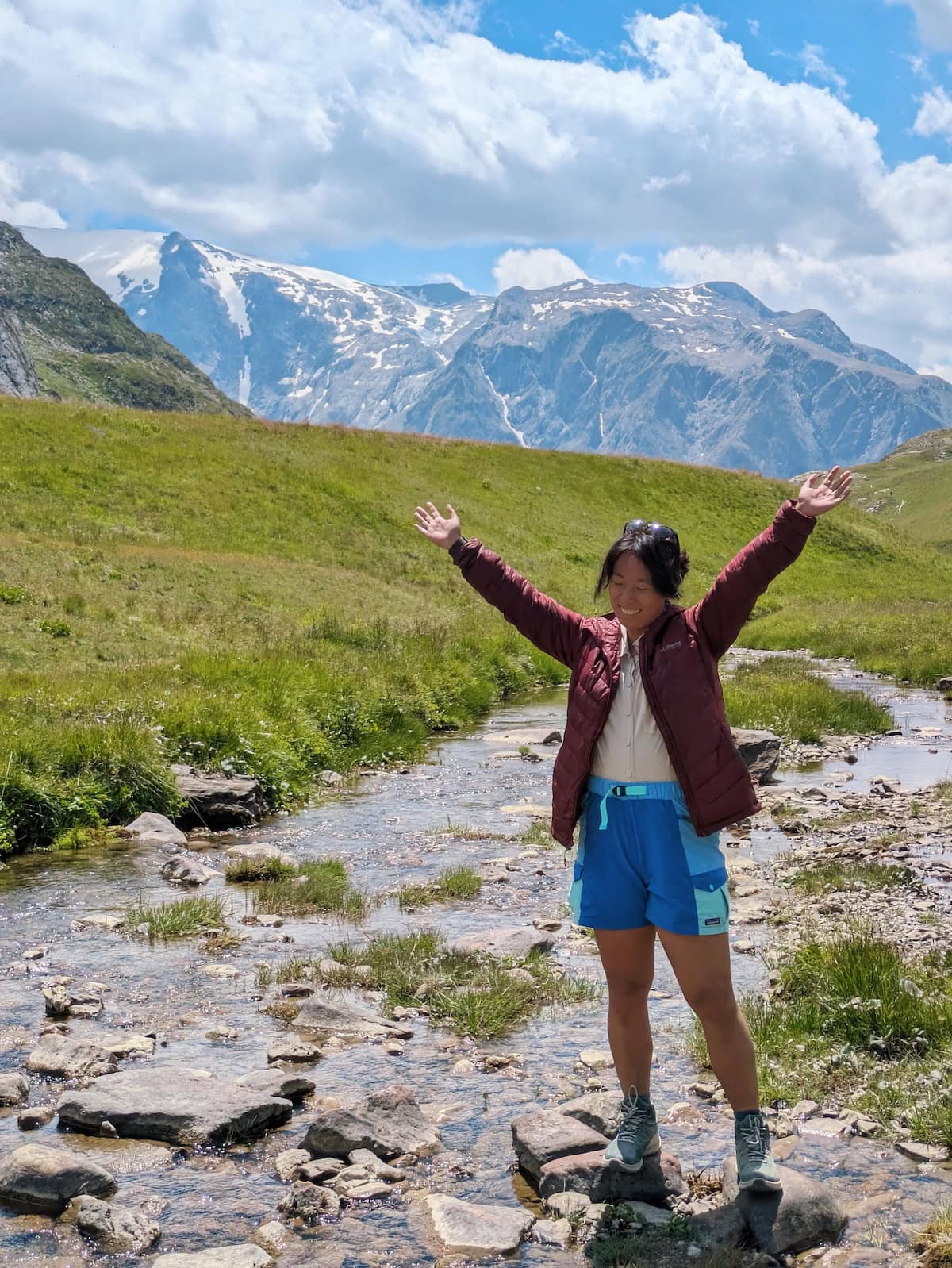
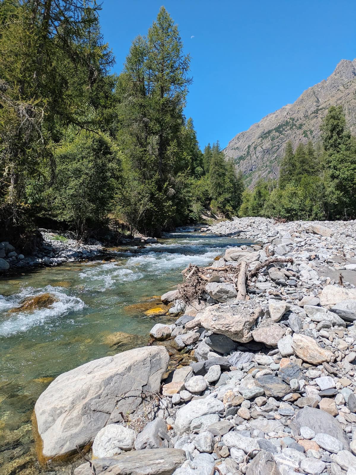
This day was also pretty flat in the beginning, as we were walking through villages and then along sparking, clear mountain streams.
The challenge of the day was the climb to the refuge, which had an up-close view of the glaciers. We regretted the offshoot at first, as the hike was rocky and exposed to the sun.
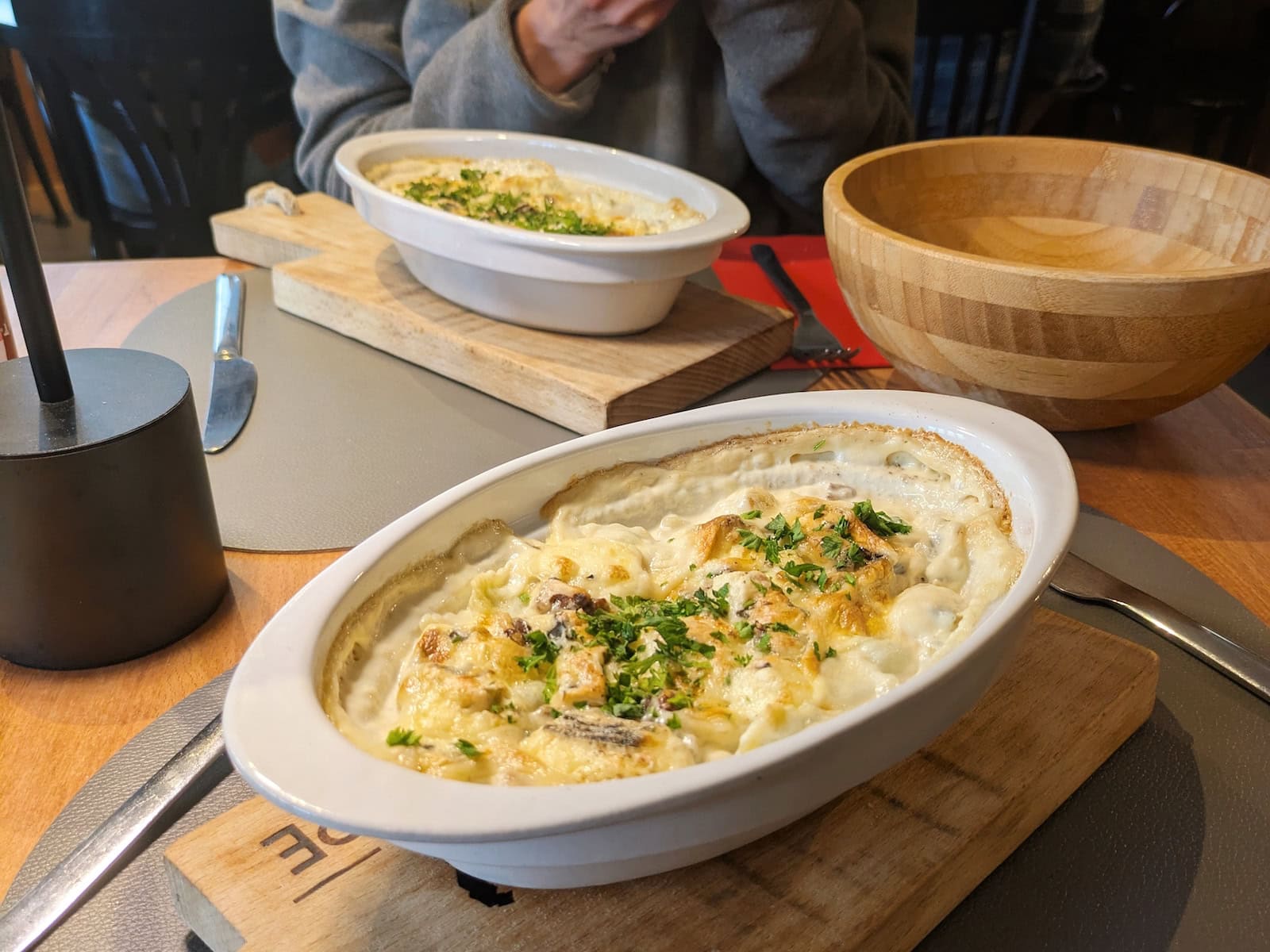
The views at the top were stunning though, and the meal we had was incredible—just imagine the cheesiest, richest pasta after a strenuous day.
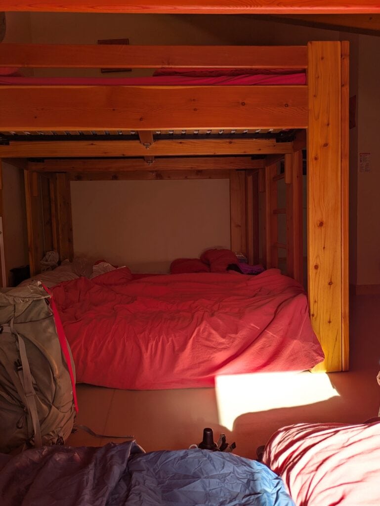
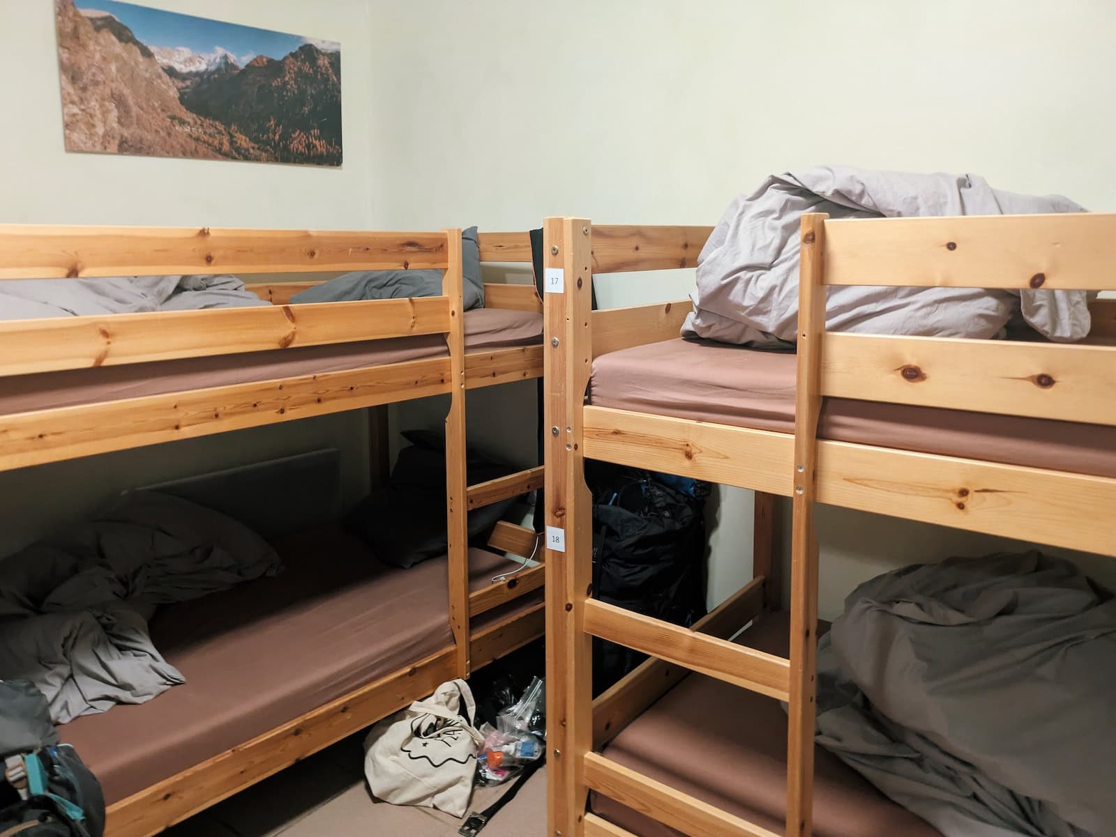
This was the most rustic refuge we stayed in, as it had around 40 beds in one big room, and the mattresses were side-by-side on the ground. The “toilet” was also an outhouse that had a hole in the ground; the “flushing” was a constant, fast-flowing stream of water from a tube that was uncontrollable and often splashed everywhere.
There were no showers and I simply brushed off with some water from a cold tub where they stored drinks (another guy just “showered” in the outhouse). This was also the first day where we also had no signal or outlets to charge our phones, so it was truly getting into nature.
Day 6: Refuge des Bans to Refuge du Pré-la-Chaumette
Stats: 13mi/21km, 4080ft/1240m gain, 4960ft/1510m loss
Where to stay: Refuge du Pré-la-Chaumette (camping or dorm)
We had to head back down the way we came, which was a bit demotivating, but we ultimately agreed that the detour was worth it.
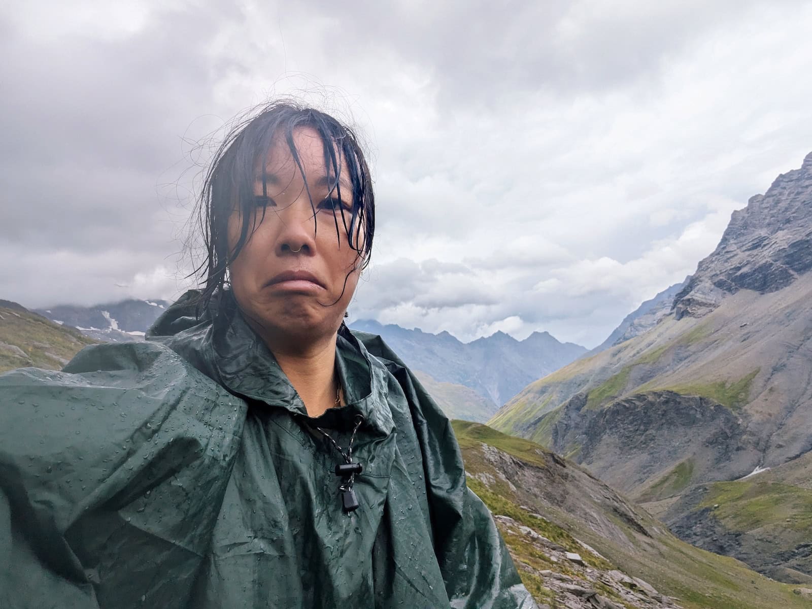
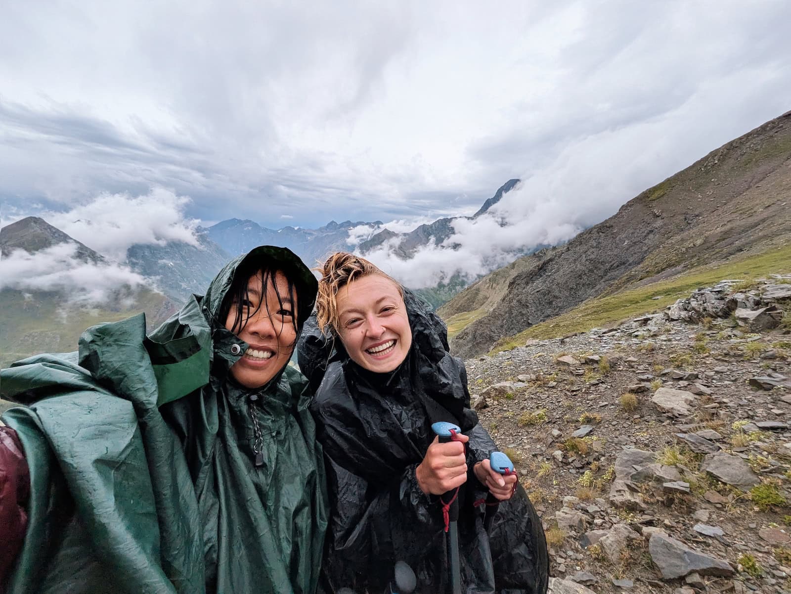
Unfortunately, we encountered a storm this day, which made the already-challenging terrain even worse. Most of the day passed by in the blur since we were fighting the wind and cold rain. My rain poncho kept blowing off and I was worried we wouldn’t make it.
Most of the climb was through some quaint streams and waterfalls, but the middle section at the peak was extremely steep and rocky. In the rain, it was slippery and dangerous. We also had super limited visibility in sections with the storm.
Like the hike up, the descent was full of switchbacks. It was a long way down, and I was so exhausted I somehow slipped and fell on a flat section and earned a big scrape.
We also passed our first flock of sheep and their sheepdogs, which we’d been warned by locals to be extremely cautious around. We had to run a bit off the trail since they went up to the fence (right next to the trail) and were growling at us.
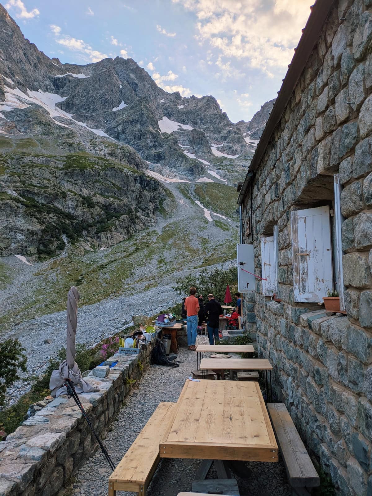
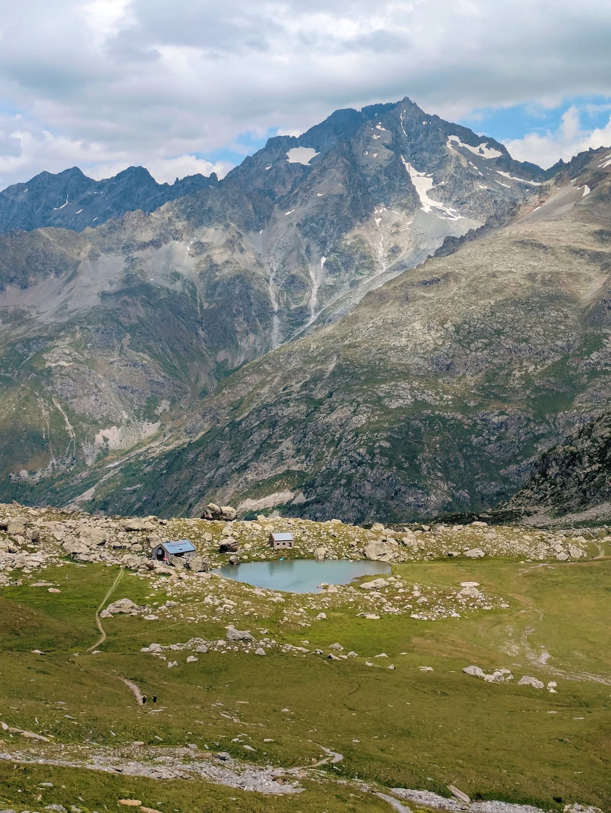
We finally reached the refuge and this one was teeming with people. It was a stark contrast compared to the previous day, where there were only 4 of us. There were several dorm rooms with around 5 bunk beds each. There were two showers that cost 3 euros for a few minutes.
We had assigned seats at dinner, and we made some trail friends that we’d end up seeing nearly every day the rest of the trek (this is when a lot of the plans converge and people stay at the same refuges).
If you prefer camping, this refuge also had a campground and some people stayed entirely self-sufficient, even cooking their own meals. Others camped and paid for meals in the refuge. We enjoyed our mostly-dry dorm rooms that night after the storm.
This refuge also had no signal, but it did have some communal charging ports in the dining hall.
Day 7: Refuge Pré-la-Chaumette to Refuge du Clot Xavier-Blanc
Stats: 11.3mi/18.2km, 3790ft/1160m gain, 5010ft/1530m los
Where to stay: Refuge du Clot Xavier-Blanc (camping or dorm)
This day involved a few literal ups and downs—we climbed three peaks and descended into two mountain valleys.
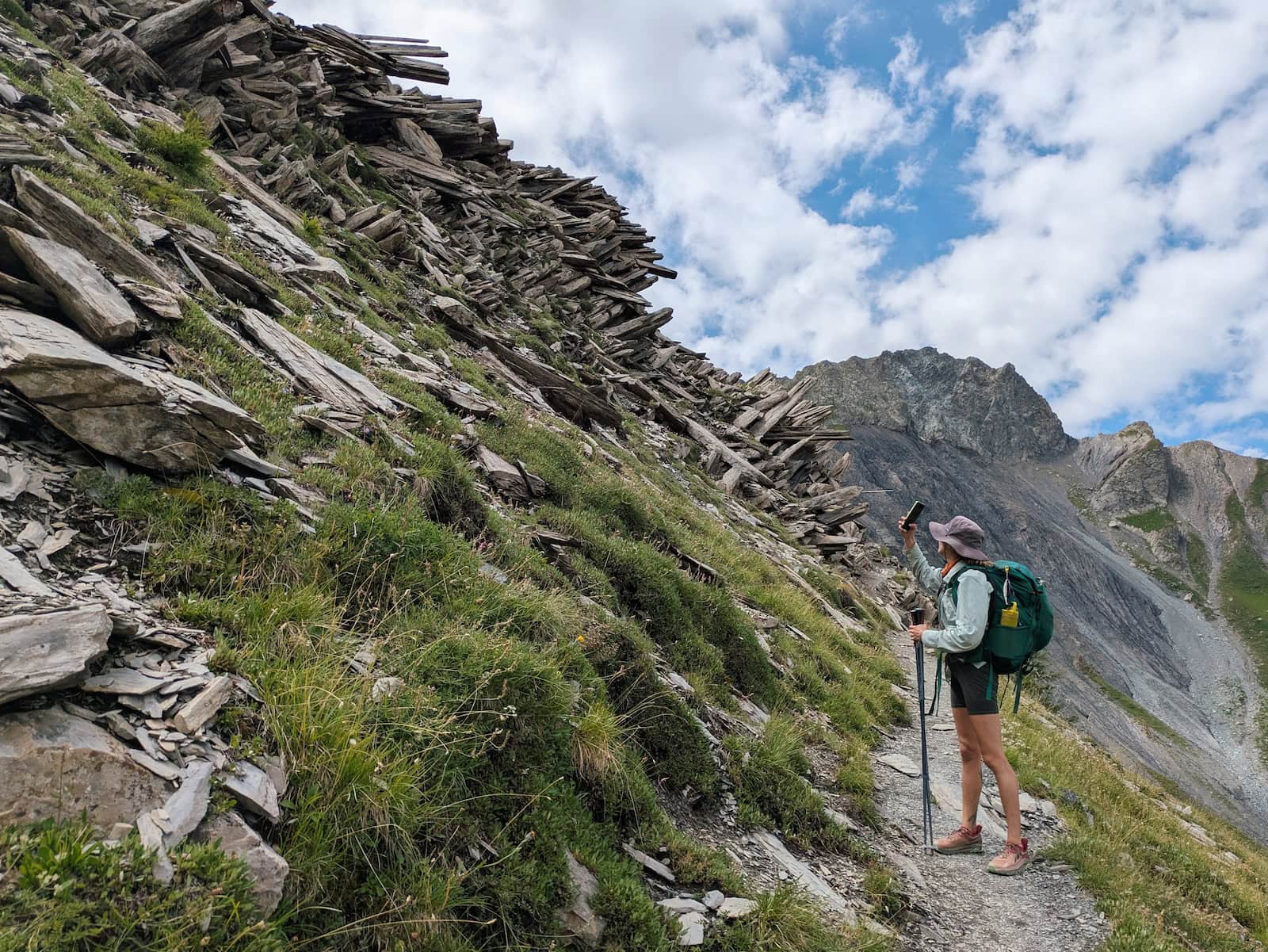
The first valley was on the drier side, so I would recommend having extra water. We luckily were able to refill from a glacier after the second peak, but I started getting worried that I would go thirsty.
Most people actually stopped midway on our route and stayed at Refuge de Vallonpierre, which was right along a beautiful alpine lake. We were a bit jealous, but wanted to have more even days in terms of distance, so we kept going to Refuge du Clot.
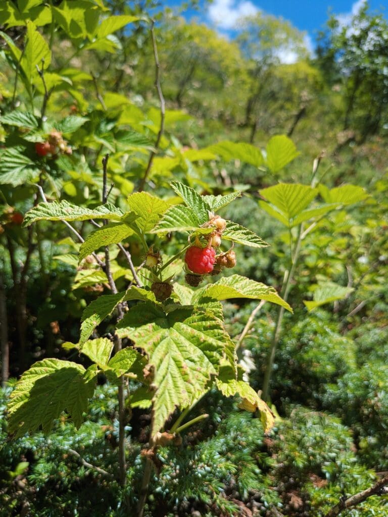
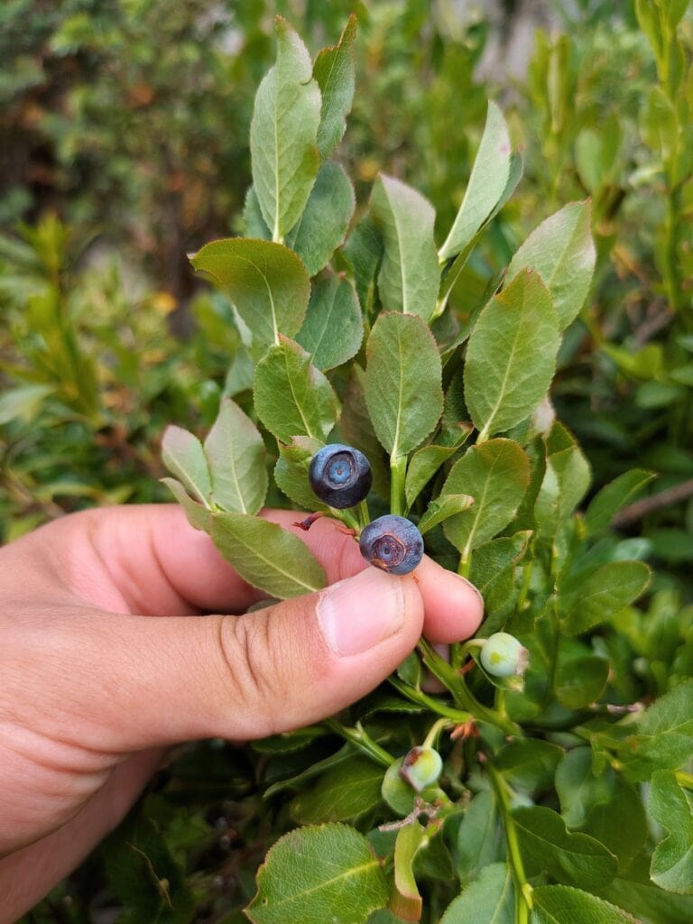
We spotted lots of wild blueberries on the way down, which were delicious. Just make sure not to eat anything too close to the ground to avoid potential parasites.
Refuge du Clot had communal charging ports, some signal, and paid indoor showers or a free outdoor one. The rooms and beds were a bit more spacious than those at the refuge the day before.
The only thing to be very careful of are the dormice. You have to leave your bags and shoes in an area that’s partially open to the outdoors, and dormice will crawl in your backpack if you’re not careful. The staff at the refuge forgot to tell us to take food out of our bags, and a dormouse pooped in my friend’s bag and ate her shorts and food. It was not a great way to start the next day.
Day 8: Refuge du Clot Xavier-Blanc to Refuge des Souffles
Stats: 11.2mi/18k, 3400ft/1040m gain, 1560ft/480m loss
Where to stay: Refuge des Souffles (camping or dorm)
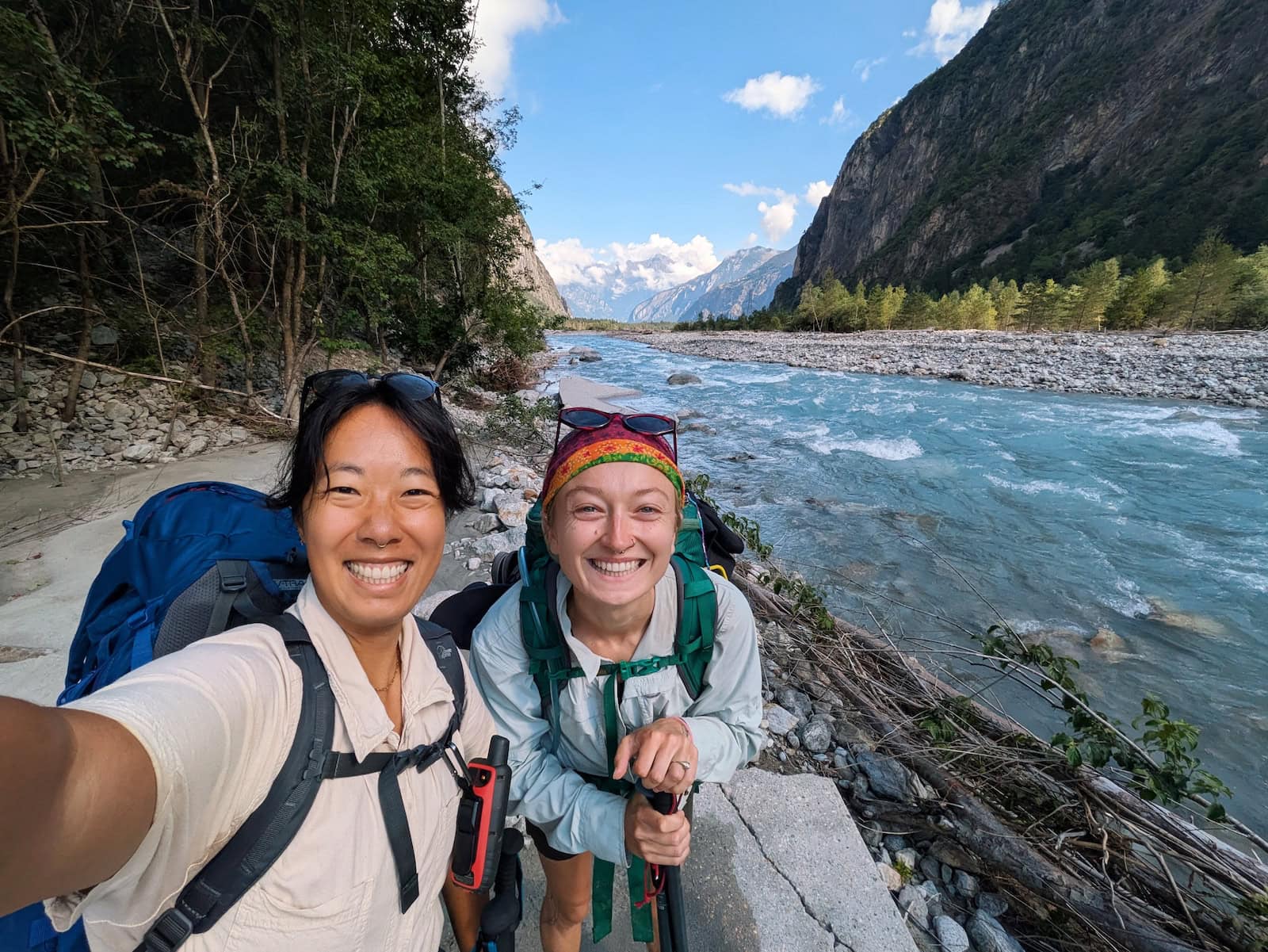
After leaving the refuge, we walked along the river to the town of La Chapelle-en-Valgaudémar. The trail was mostly flat and we had our first sighting of civilization in a few days. We hadn’t seen roads, cars, or shops since day 5.
La Chapelle-en-Valgaudémar had plenty of shops and restaurants, so we stocked up on snacks and camp food, and got ingredients for lunch.
After leaving the town, we sat and ate lunch by the river before starting the climb. The rest of the day was uphill through the forest. We saw tons more wild blueberries and that helped give us energy for the grueling trek.
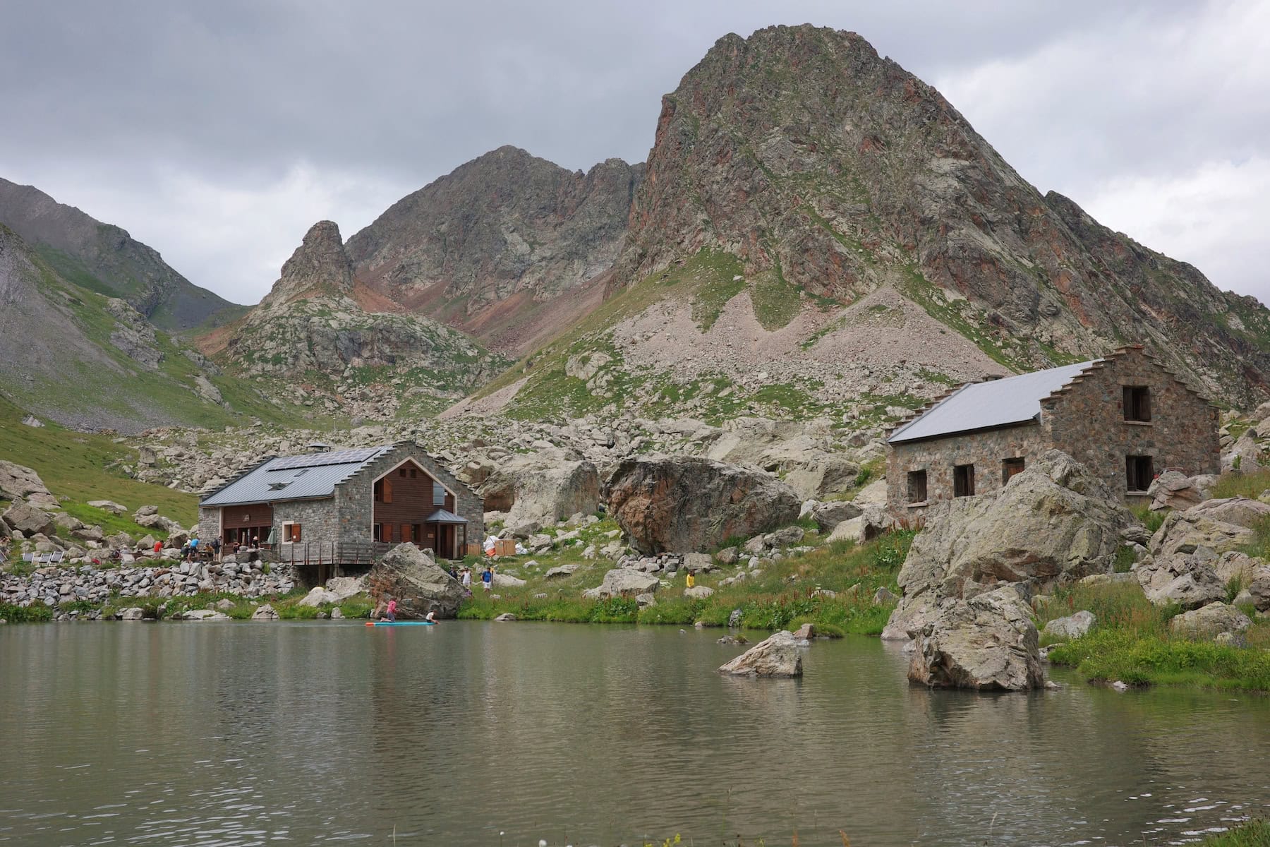
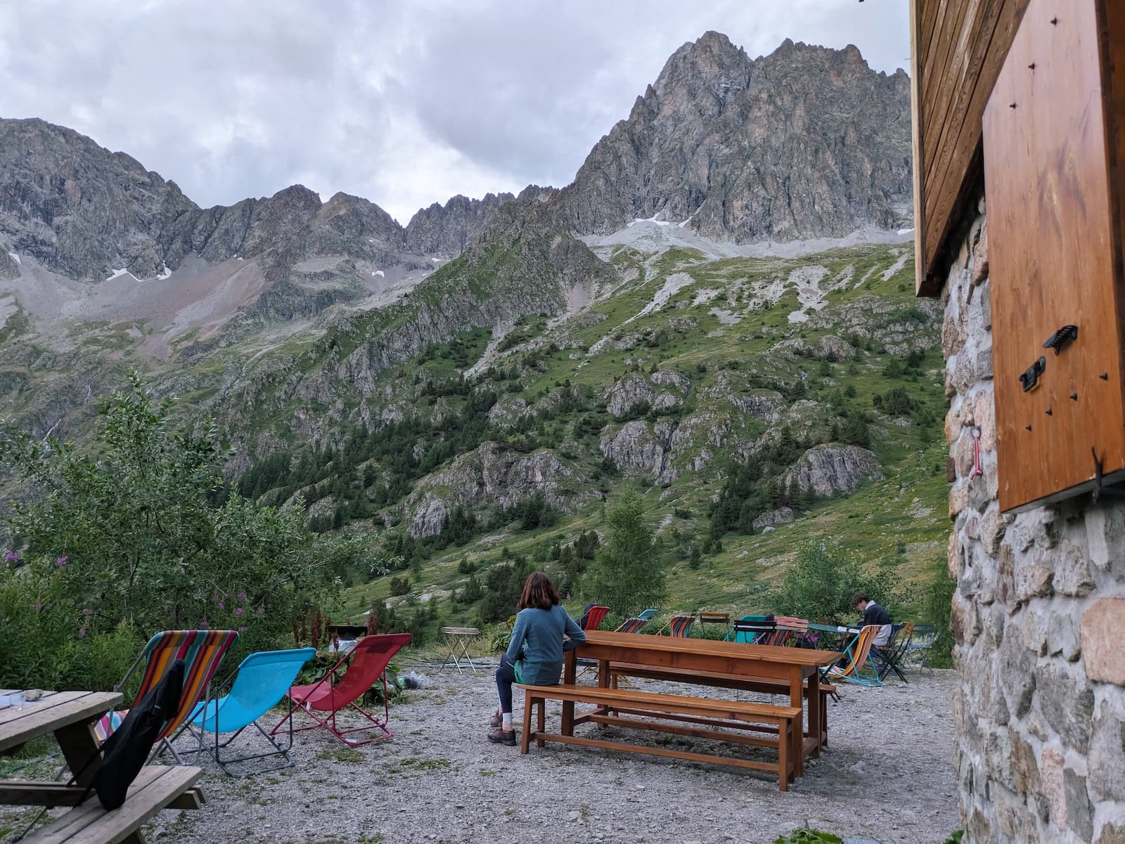
We finally reached the refuge and were greeted with stunning views of the craggy mountaintop.
We were a bit worried about Refuge des Souffles given the lower Google reviews, but this was one of our favorites.
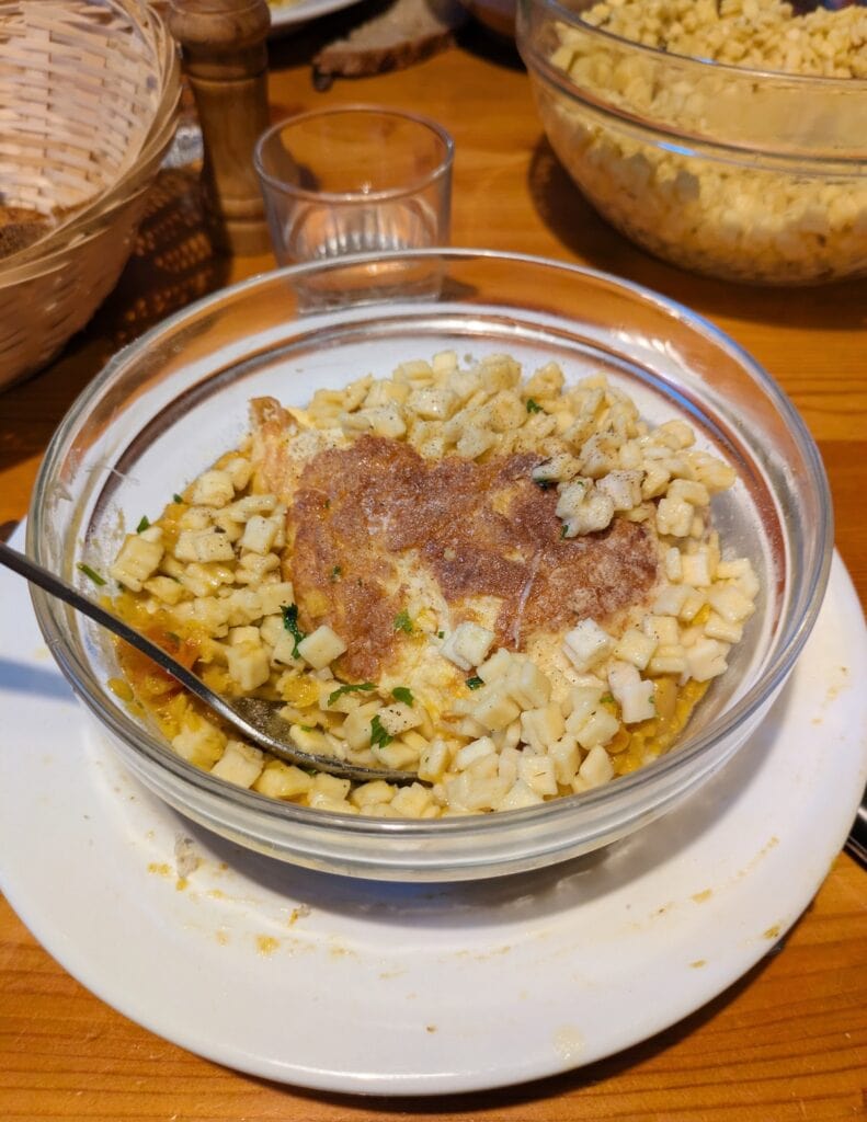
The rooms were a bit more spacious and airy, and the dinner was unique and fun. We had crozets, which are a local tiny pasta, as well as brownies with Christmas decorations for dessert. The refuge manager/”guardien” also gave us alcohol-doused sugar cubes and told us the story of the refuge’s origin.
There were also hot, 3-minute showers for a few euros each. There was no signal or charging ports. If you wanted to camp, that was also possible at this refuge.
We had a cozy night here with our friends from days 5 and 6, and left with fond memories.
Day 9: Refuge des Souffles to Gîte les Arias
Stats: 7.2mi/11.6km, 3260ft/990m gain, 3180ft/970m loss
Where to stay: Gîte les Arias (camping or dorm)
Our original route combined days 9 and 10, but we decided that was going to be too intense; it would’ve meant traipsing over two mountain passes in one day, and we were suffering from the cumulative fatigue. We woke up sore every day only to have to make ourselves more sore.
So, we took two lighter days that were about half as long as usual. We grabbed a “pique-nique” from the refuge (they’re lunches you can order the night before), and headed across the base of the craggy peaks we were admiring yesterday.
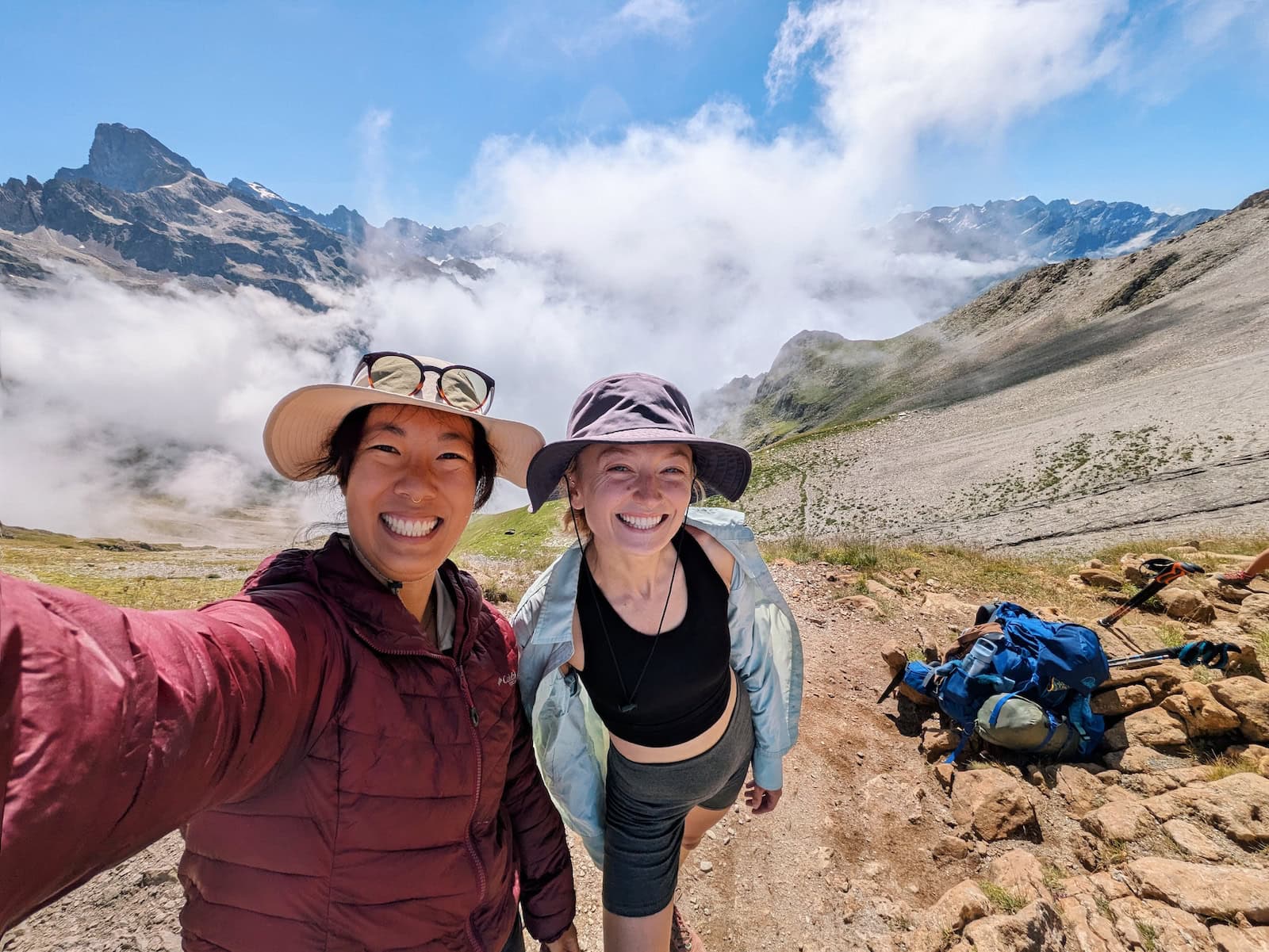
After walking through the thick fog, we reached the mountain pass and admired the views on both sides. We had lunch and took a long break with a lot of our trail buddies.
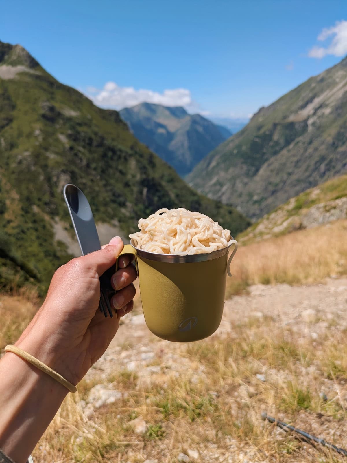
This day had a lot of elevation loss, so on the way down, we took another break and had some trail ramen.
Gîte les Arias was in a tiny village and one of the nicest places we encountered. It was newly-renovated and had hot showers with no time limit. They were free if you were staying in the dorms, but a couple euros otherwise. We’d decided to camp this day, so we simply paid for our campsite, meals, and showers.
There was a communal charging bank, but it didn’t work super well and some of our friends took my phone to their room to be charged. There was cell signal which was nice.
I slightly regretted not getting a dorm room since the accommodations were so nice, but camping was peaceful and the stars were otherworldly. I’ve never seen such bright, milky constellations.
I highly recommend making a stop at this gîte and taking a peek outside at the night sky.
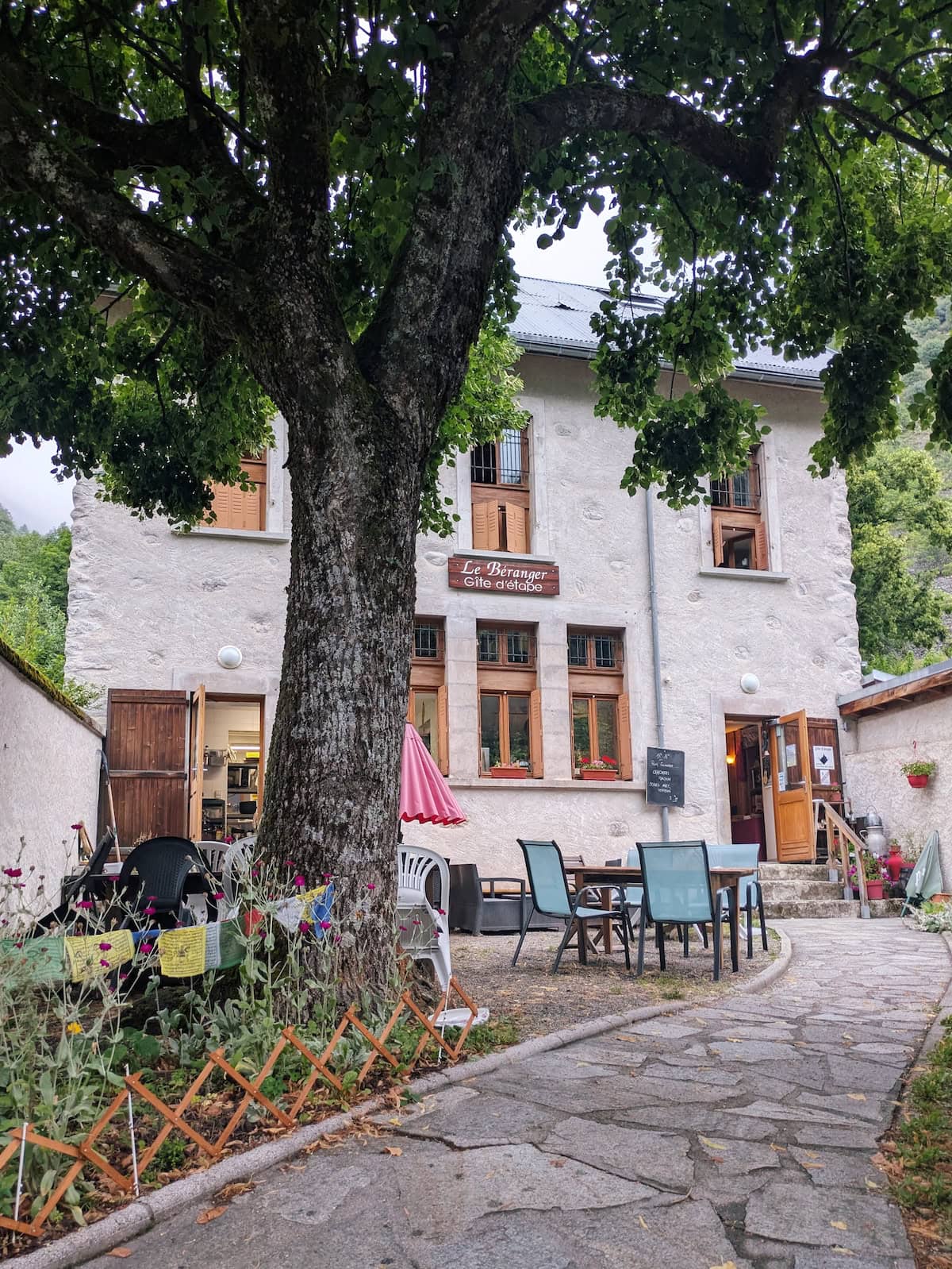
Day 10: Gîte les Arias to Gîte le Béranger
Stats: 7.4 mi/11.9km, 3260ft/990m gain, 3180ft/970m loss
Where to stay: Gîte le Béranger
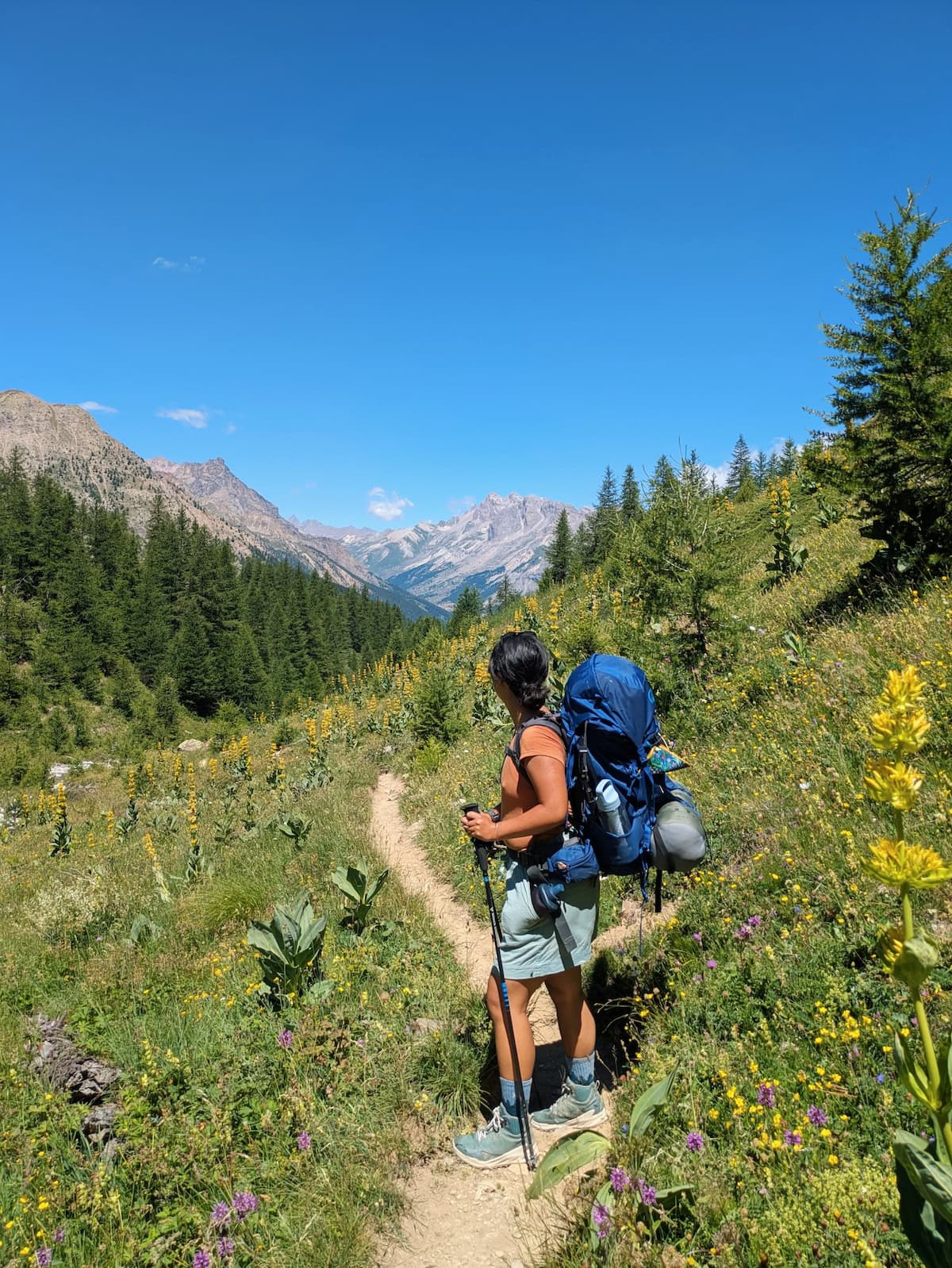
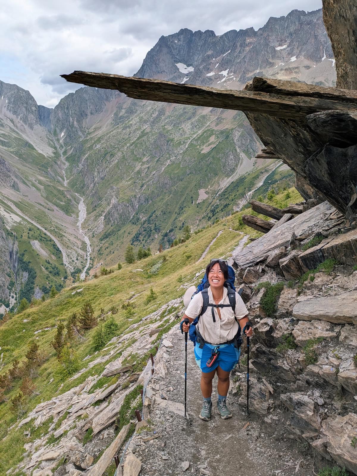
This was another shorter day, and we needed it again. We climbed over another mountain pass with rock formations fit for a fantasy movie—the sharply-cut rock jutted out of the ground, creating an overhang for us to walk under.
We then descended into a fairytale forest full of unique wildflowers, moths, and butterflies. It was an ecosystem unlike any other we’d seen during the hike.
We then made it to our final refuge/gîte, where there were hot showers and outlets. I promptly took a nap and then shared some dessert with Tessa. Dinner was homey and filling, and there were plenty of leftovers.
We played an unhinged French card game with two other hikers our age to round out the night. It was called Smile Life, and the goal of the game was to build the best life while ruining others’. You could break couples up, throw people in jail, steal their money, and more. It was like the Cards Against Humanity version of the Life board game.
The next day was going to be our biggest, so we turned in right after and mentally prepared ourselves for the challenge.
Day 11: Gîte le Béranger to La Danchère
Stats: 12.5mi/20km, 6000ft/1830m gain, 7380ft/2250m loss
Where to stay: Lauvitel Lodge
I consider this our last day of true hiking, as the final day was a light downhill back to the starting point.
This day was brutal. We saw the steep mountain on our descent the day before, and it was a huge stretch of switchbacks to scale from the base to the peak of the mountain.
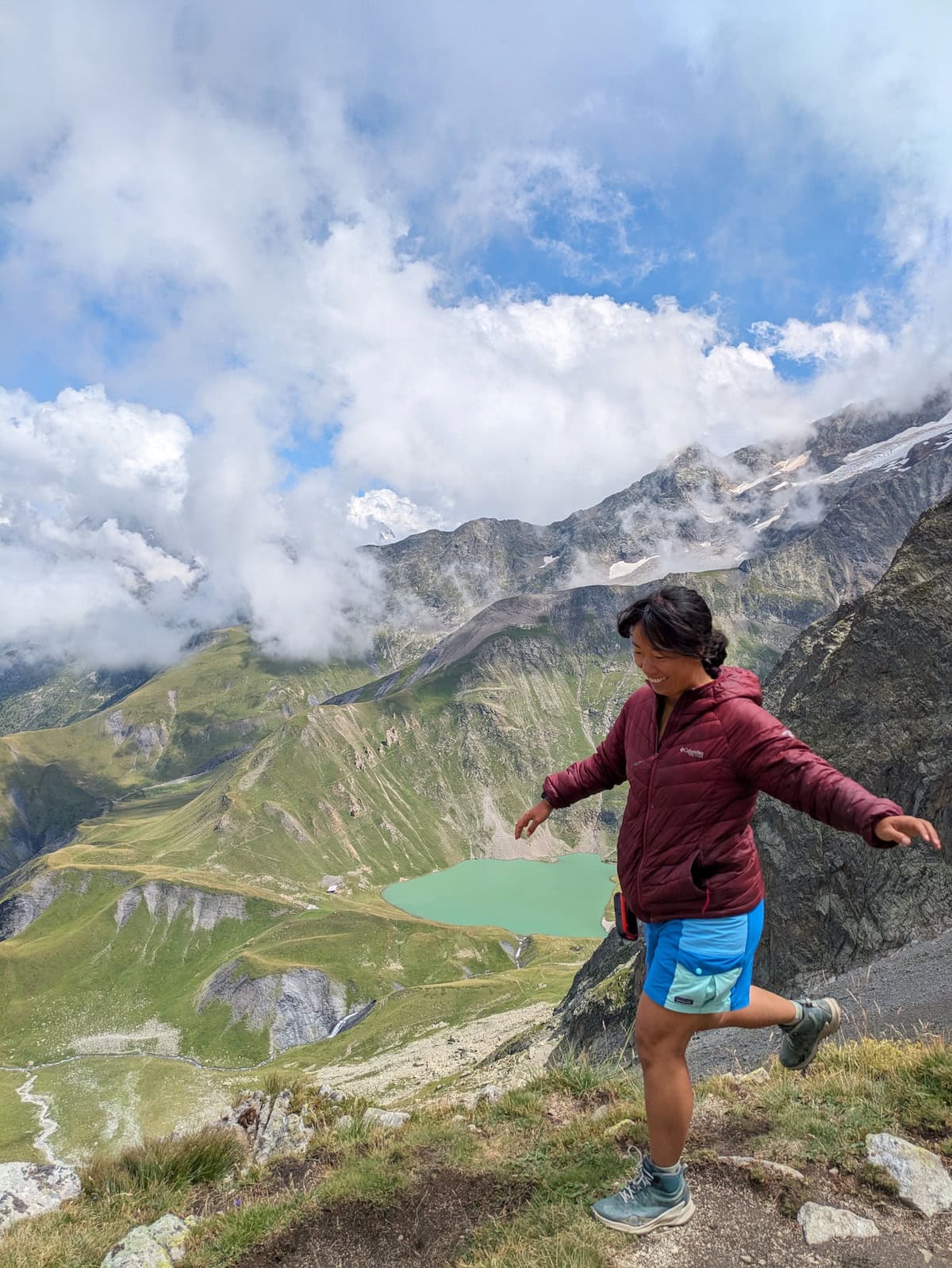
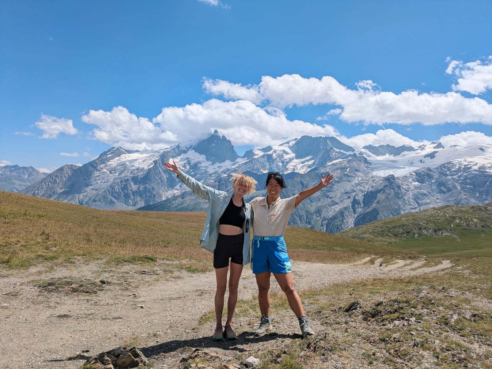
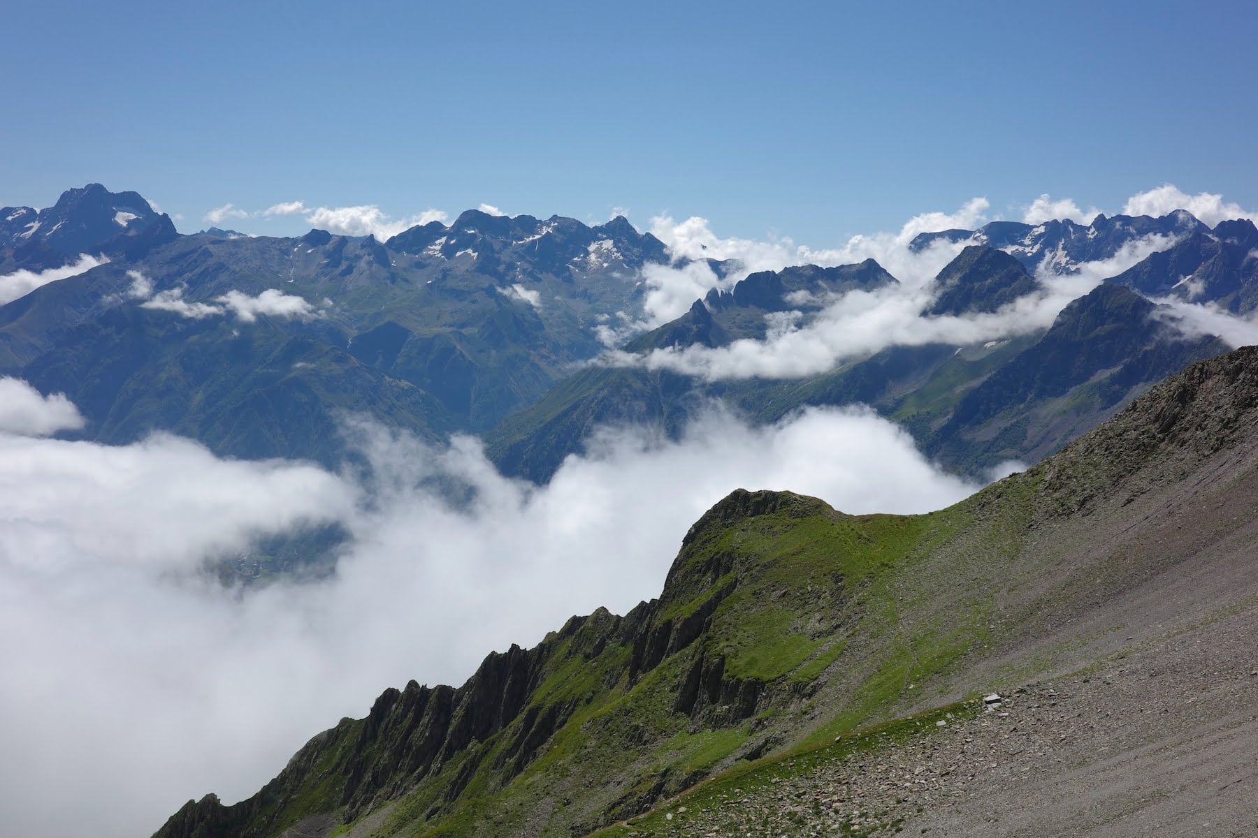
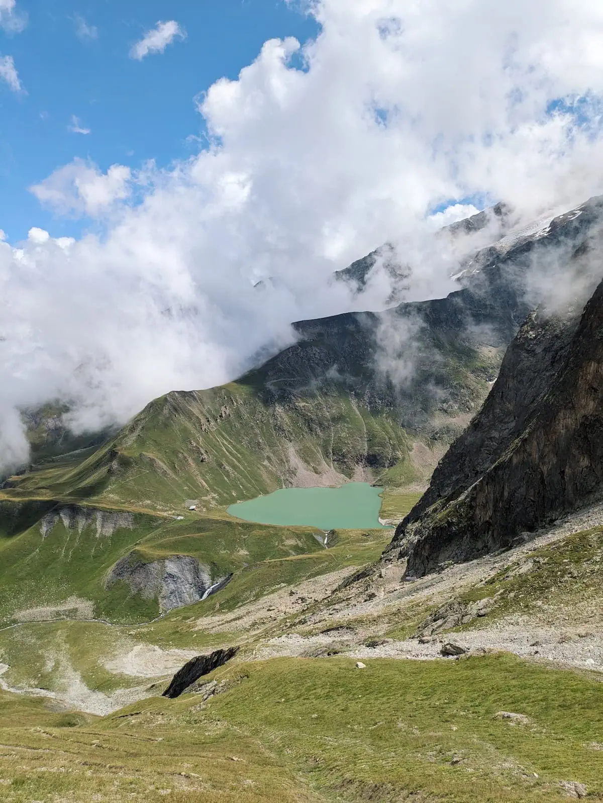
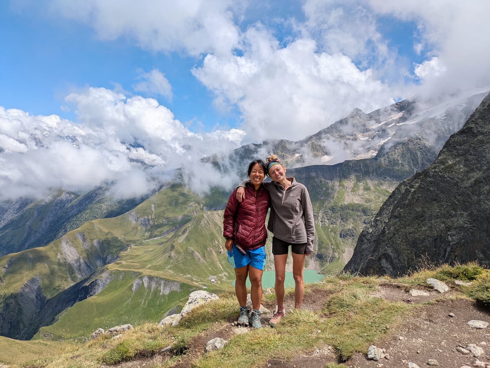
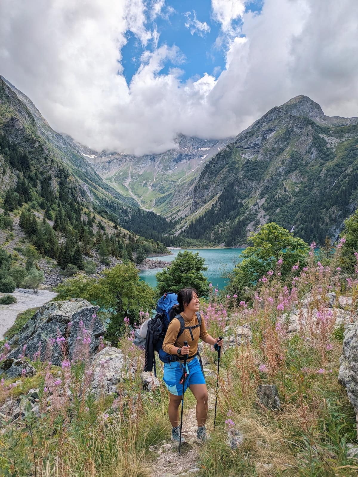
The weather wasn’t in our favor again, and the misty wind pummeled me as I tried to navigate the slippery rock path. Luckily, at the first peak, the clouds broke and we got a view of the alpine lake below (Lac de la Muzelle). We ate our lunch and took a breather before descending towards the lake.
The valley had some of the most impressive views we’d encountered: glacier waterfalls, grassy fields, clear streams, and the deep mint water of Lac de la Muzelle.
Many of our friends stopped at the refuge at the lake, but our stay involved one more climb and a long descent.
The final climb was tough, but the payoff was a majestic view of Lac de la Muzelle, framed just right by the clouds. We had a snack break and a photoshoot before starting the descent.
The worst part of the day was actually going down. It was long and it hurt a lot. We did catch beautiful views of Lac du Lauvitel, another turquoise alpine lake, and even stopped by briefly. But the climb down destroyed our legs, and I even slipped and fell from the fatigue.
After passing by the second lake, we spent the last couple miles in the forest, where we groaned for the finish the entire time. We didn’t make it to our stay until 7pm, after nearly 12 hours of hiking.
We stayed in a local’s Airbnb, taking the other side of their mountain cottage. Unfortunately, there was no food around and we had to make do with the last of our camp food. We’d wanted to stay at Lauvitel Lodge but it was booked out for an event. The place was lovely though and we were able to do some laundry and warm up with tea.
Day 12:La Danchère to Le Bourg d’Oisans
Stats: 5.7mi/9.2km, 270ft/80m gain, 610ft/190m loss
Where to stay: Go back to Grenoble and treat yourself to a nice hotel
The final day was easy. Just a stroll through the village, by the river, and mostly along paved path back to the starting town. We saw plenty of other walkers this day, including families with kids.
The only tricky part was that we somehow lost the trail and ended up by some rocks next to the river, then had to climb through the rocks in the woods to get back on the trail.
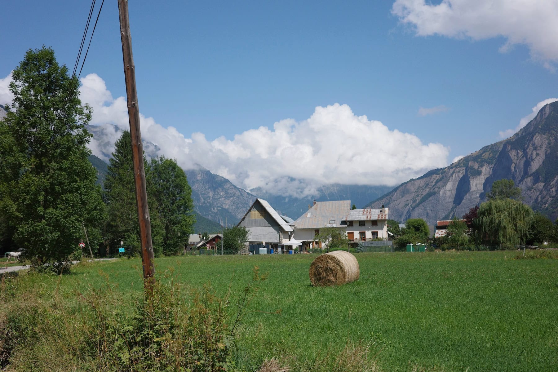
It was a huge relief to see Le Bourg d’Oisans again. We promptly ordered pastries to celebrate, then picked up our stuff from our original homestay.
We’d decided to spend that night in Grenoble, so we hopped on the bus and that was the end of our GR54.
GR54 Packing List
Hiking backpack—I borrowed a friend’s bag for the trip, but I now own the REI Flash 55 Pack. I wish I’d had this for the GR54 because it’s so light and can hold 55L.
Rain cover—To keep your belongings dry in your bag when it rains. This one fits 50-65L bags.
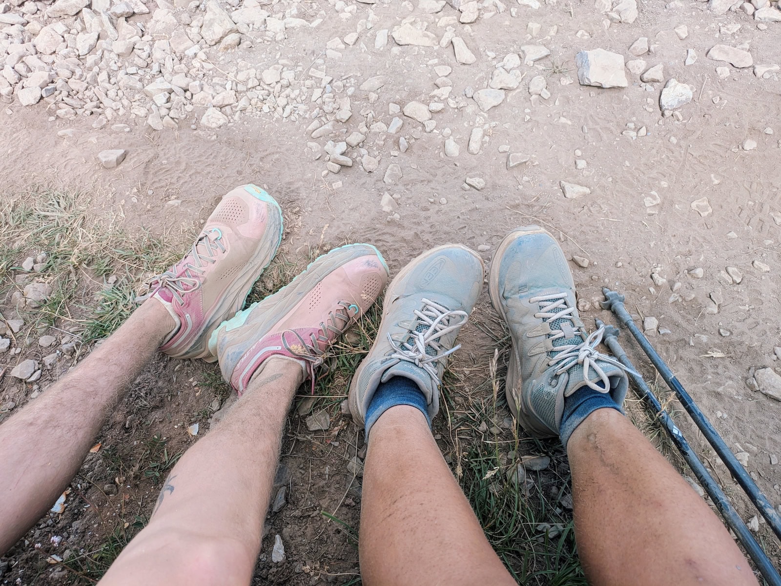
Hiking boots or trail shoes—I wore some lightweight Keen hiking books that are no longer sold. My friend wore trail runners. I would recommend the Merrell Moab Speed 2 since they’re lightweight but sturdy and can also be worn as chunky city shoes.
T-shirt and shorts (x2)—Bring one to wear and one to change into. If you don’t mind starting the day in a slightly-damp set, you could probably get away with just one each. By the end, I’d gotten rid of everything except one t-shirt. For shorts, I’d recommend having big pockets or belt loops, as I used them to hold my squeeze bottle and navigation device. I mainly wore the Patagonia Everyday shorts. For t-shirts, look for something lightweight and quick-drying. I mainly wore a thrifted camp shirt.
Base layer—A tech or merino wool layer will keep you warm in the evenings.
Joggers or leggings (x2)—Something to wear at night or during colder days. I brought one pair of warmer joggers and one pair of water repellent ones.
Fleece OR packable puffer—In my opinion, you don’t need both. I brought both and ended up shipping my fleece back mid-trip. I wore an old puffer I had and it was fine, but if you need a rec, Patagonia or Cotopaxi have quality ones.
Rain jacket—We were blessed with clear skies most days, but a rain jacket is absolutely necessary since the weather in the mountains is unpredictable. I wish I’d had a better rain jacket like the one I linked instead of my old poncho. Tessa borrowed my friend’s and it even had space to cover the backpack. It was from Decathlon. I didn’t take it because it was a bit bulkier than a typical jacket.
Undergarments (sports bra, underwear, socks)—You don’t need more than 3 pairs each: one to wear, one to change into, and one backup. We washed our clothes daily in the sink and dried them overnight. They were usually damp in the morning, so we strapped them to the outside of our bags and the sun did the rest. I recommend merino wool for undergarments since it dries quickly, and for socks in particular, I picked Darn Tough since they have lifetime warranty.
Sleeping bag liner—If you stay in refuges, you’ll need a liner for the beds as they don’t wash the linens every night. It’s required in most places. You can also just use your sleeping bag if you bring camping gear (this is what we did). If you’re camping, you’ll also want a tent, camp pillow, sleeping bag, and sleeping pad. I would honestly recommend buying most of this in France at Decathlon so you don’t have to travel with it.
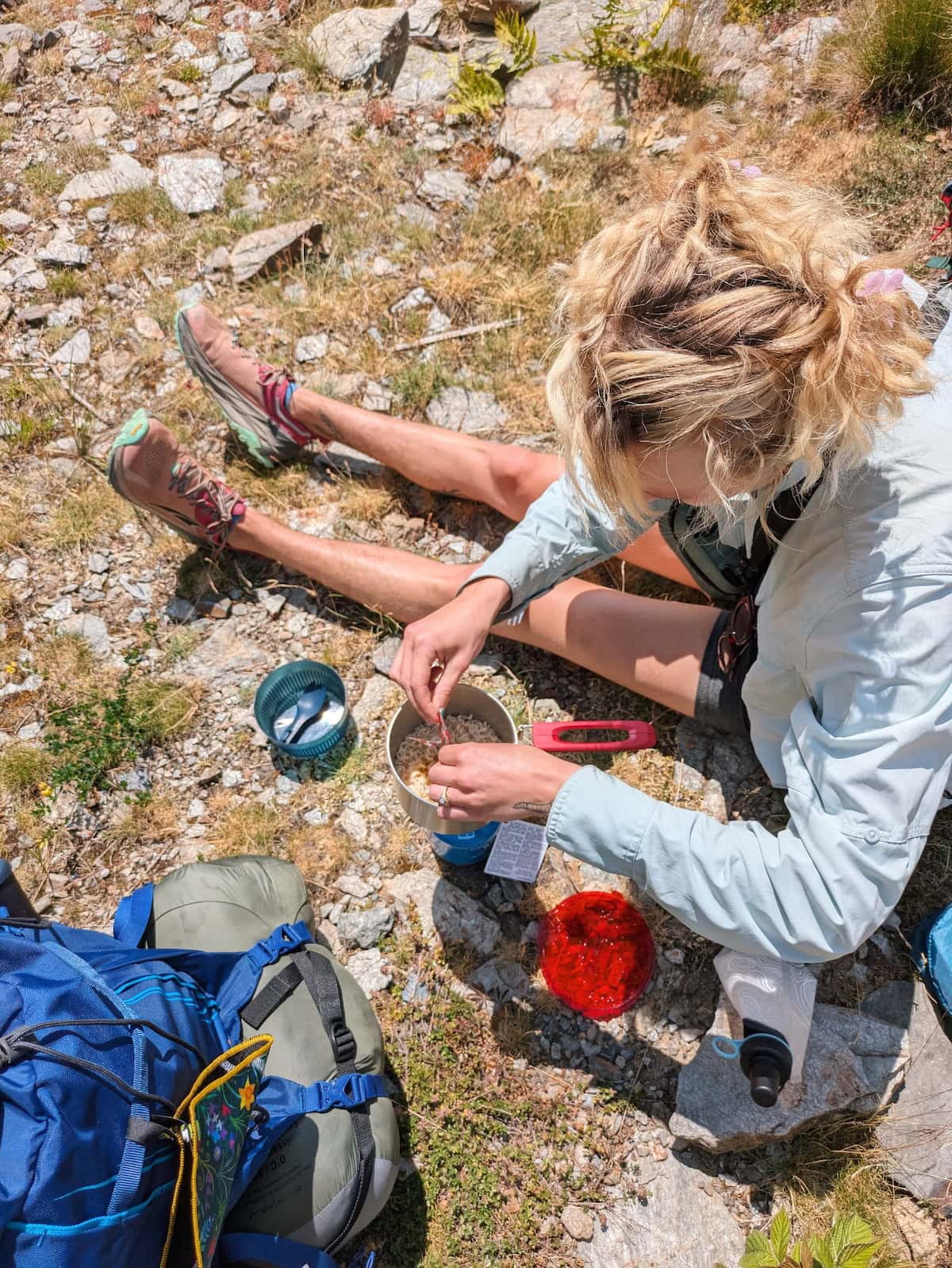
Camping cooking set and gas canister—While we mostly ate in refuges, we did cook a handful of times. We didn’t use a whole canister of gas, but if you run out, there are canisters for sale in La Chappelle-en-Valgaudémar (day 8). You can also get these at Decathlon in France and I would recommend buying the camping stove and gas canister together to make sure they’re compatible (also probably not a good idea to bring a gas canister on a plane). Also be sure to bring some utensils.
Water filter—I carried a 1L water bottle with a filter and a smaller squeeze bottle with a filter for cooking. I have no complaints. We were able to fill up along the way most days, so I never carried more than 1L on me at a time.
Power bank—Some days you won’t be able to charge your devices, so you want to have a backup power bank.
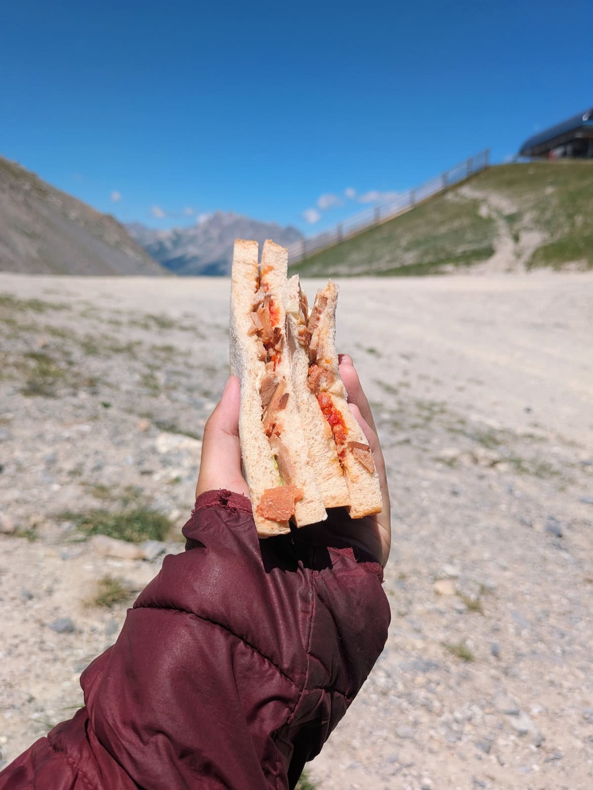
Food—We bought camp food at Decathlon and restocked at grocery stores along the way. We mostly ate basic sandwiches for lunch and had the rest of our meals at the refuges.
Cash—While you pay a deposit by credit card online for the refuges, you have to settle the rest in cash most times. Only the auberges and gîtes tend to take card. Make sure to take enough before you leave Le Bourg d’Oisans as ATMs are limited.
Esim—I wish I’d gotten unlimited data for this as I kept running out during my time in France. Also, since there is often no wifi, having data was a big help. I use GigSky for my eSims.
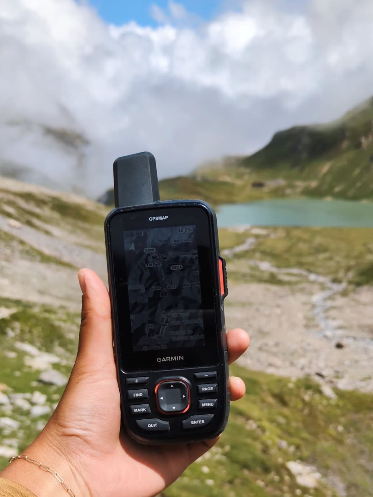
Navigation device—I bought a Garmin 67i satellite device to be able to navigate and send text check-ins/SOS without cell signal. An inReach is a cheaper option with rescue and communication features, but the Garmin 67i also has mapping, so that’s why I got it. You do need to buy a subscription for the satellite features. I also downloaded the GPX tracks from Komoot onto my COROS GPS watch. I had the APEX 2 at the time, but would recommend the APEX 4 since it’s the most up-to-date version. (If you decide to get one, you can use my code COROS-Lily to get a free extra watch band). I love COROS because you don’t have to charge them that much. The watch lasted all day and could even go a second day.
Toiletries (toothbrush, toothpaste, floss, sunscreen)
Bathroom kit—While you can mostly avoid peeing or pooping in the woods, it’s important to have a kit just in case. I recommend the Kula cloth for an antimicrobial reusable pee wipe, a lightweight hand shovel, a small roll of toilet paper, and hand sanitizer. I also got a bidet bottle cap but didn’t use it as much as I thought I would.
Medication—Remember your prescriptions and any first-aid meds you might need like ibuprofen and Neosporin. I took ibuprofen several times since I was in pain in the evenings from the hiking.
Tick remover—While we personally didn’t encounter any ticks, they’re definitely something to look out for.
Let me know if you have any questions, and happy trails! If this post helped you, it would mean a lot if you considered buying me a ko-fi. This post was a labor of love and I’ll use the money for my next trek :)


Stunning views! Looks like quite a challenge to do the whole trip
Yes, it’s definitely a big trek but very worth it!